Croy Hill Roman fort, Roman fort on Antonine Wall in North Lanarkshire, Scotland.
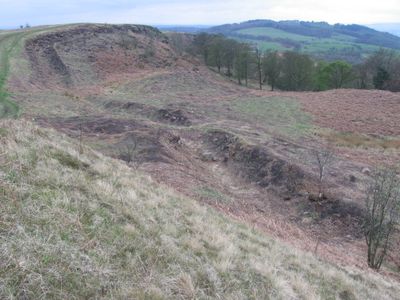
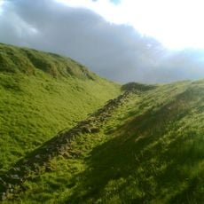
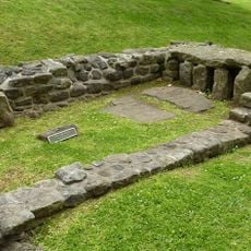
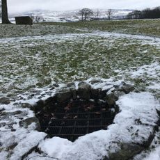
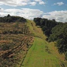
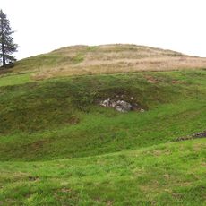
Croy Hill Roman fort is a military installation on the Antonine Wall in North Lanarkshire, Scotland, set on a raised plateau. The remains visible on the ground include the outlines of a granary, a headquarters building, and the earth ramparts that once formed its defenses.
The fort was built around 140 CE as part of the Antonine Wall, Rome's northernmost frontier in Britain. Excavations carried out in the 1920s and 1930s brought the layout of the camp to light and helped define its role on the frontier.
Religious objects found here suggest that Roman soldiers worshipped deities like Jupiter and Mars in this distant outpost. The remains reveal how occupiers maintained their spiritual practices far from home.
The site lies between the villages of Croy and Dullatur and can be reached by minor roads from the B802, with Croy train station within walking distance. The ground is uneven, so sturdy footwear is a good idea, especially since the elevated position can make it exposed in wet or windy weather.
At this point along the Antonine Wall, the defensive ditch that runs along most of the wall was never dug, because the bedrock here is made of hard basalt and dolerite. This makes the spot especially interesting to researchers, as it shows how the Romans adjusted their construction plans when the ground made standard work impossible.
The community of curious travelers
AroundUs brings together thousands of curated places, local tips, and hidden gems, enriched daily by 60,000 contributors worldwide.