Shire Hall, Shinfield Park, Municipal building in Shinfield Park, England
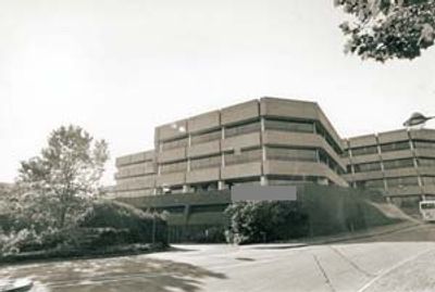
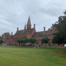
Shire Hall is a Brutalist building south of Reading composed of seven octagonal structures connected by continuous bands of glazing and concrete elements at staggered levels. The arrangement of these linked forms creates a distinctive appearance that stands out against the surrounding landscape.
The building was inaugurated by Queen Elizabeth II in 1982 and served as the headquarters for Berkshire County Council until 1998. Afterward it transitioned to new uses, reflecting broader changes in English local government administration of that period.
The building represents a transition in British local governance, marking the shift from county councils to unitary authorities in the late 1990s.
The building sits in Shinfield Park south of Reading with surrounding grounds accessible to visitors walking through the area. While the exterior can be seen and photographed freely, the interior is not typically open to the public for tours.
A Cold War emergency control center remains hidden in the basement, built to protect key personnel during potential threats and now serving as a reminder of that era's security concerns. This underground space reflects the defensive thinking that influenced the building's overall design.
The community of curious travelers
AroundUs brings together thousands of curated places, local tips, and hidden gems, enriched daily by 60,000 contributors worldwide.