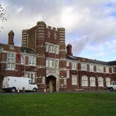
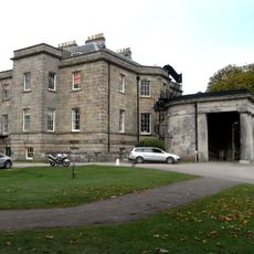
Ilford Park Polish Home, Residential care facility in Stover, United Kingdom
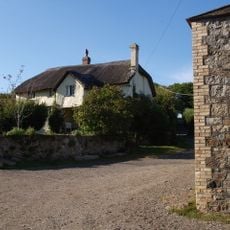
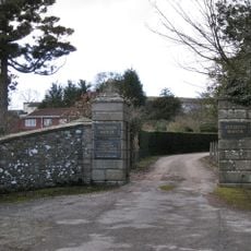
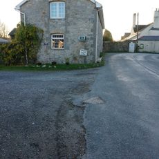
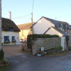
Ilford Park Polish Home is a residential care facility in Stover that provides accommodation for individuals requiring different levels of support. The complex features separate sections for residential care, nursing care, and independent living arranged across multiple buildings.
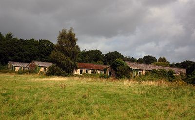
The home was established in 1948 at Stover Camp as a refuge for Polish veterans following the Second World War. It underwent major reconstruction in 1987 and reopened in 1992 to better serve the settled Polish community.
The home maintains Polish language and cultural elements through bilingual staff and traditional touches that feel familiar to residents. Visitors can sense a living connection to Poland woven into daily life and interactions.
The facility is a specialized care home managed by the British government that provides medical support for residents with varying care needs. Visitors should be aware that access and visiting are regulated as it is a private care establishment.
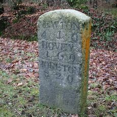
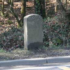
This is one of the last remaining operational facilities from a network of about 45 camps established after the Second World War for displaced Polish people. The site therefore documents an important chapter of British post-war history and Polish diaspora.
GPS coordinates: 50.55861,-3.65306
Latest update: December 14, 2025 11:04
Seale-Hayne College
1.4 km
Stover
894 m
Bickington Steam Railway
893 m
Stover Country Park
921 m
Bovey Heath
2.1 km
Church of St Peter and St Paul
2.1 km
Lock 350 Metres South-East Of Church Of St Peter And St Paul
2.4 km
Bridge Approximately 300 Metres North Of Stover House
738 m
Seale-Hayne
1.5 km
The Granite Lodge Adjacent A38 Approx 1550 Metres North-north-west Of Stover House
1.2 km
New Bridge
2.7 km
Barn Range To The North East Of Higher Staplehill
933 m
Moorview
2.7 km
Ingsdon Mill Mill House
2.7 km
Stover House
895 m
Rora Farmhouse
2.9 km
Milestone About 1,865 Metres South East Of Junction With Ashburton Road
1.8 km
Pair Of Entrance Piers At East Entrance To Ingsdon School, Including The Flanking Walls
2 km
Milestone On South East Side Of The Old A38, About 40 Metres North East Of Saddlecombe (Formerly Holbrook) Farm Gate
2.6 km
Milestone On North West Side Of Old A38 At East End Of New Benedicts Bridge
1.3 km
Mill House
2.8 km
Mounting Block And Gate Posts To South East Of Higher Staplehill
959 m
Milestone Approximately 375 Metres North-West Of Stover Bridge
417 m
Lock 100 Metres North North-East Of Hearders Farmhouse
2 km
Causeway And Floodarches Immediately South-West Of Teignbridge Railway Crossing
2.9 km
Hearders Farmhouse
2 km
Sampson's Farm Restauarant
2.6 km
Milestone, Drumbridges roundabout, 50m down from exit slipway
894 mVisited this place? Tap the stars to rate it and share your experience / photos with the community! Try now! You can cancel it anytime.
Discover hidden gems everywhere you go!
From secret cafés to breathtaking viewpoints, skip the crowded tourist spots and find places that match your style. Our app makes it easy with voice search, smart filtering, route optimization, and insider tips from travelers worldwide. Download now for the complete mobile experience.
A unique approach to discovering new places❞
— Le Figaro
All the places worth exploring❞
— France Info
A tailor-made excursion in just a few clicks❞
— 20 Minutes