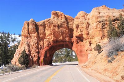
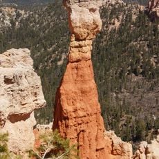
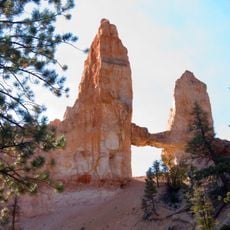
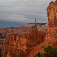
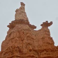
Red Canyon Arch, Natural arch in Garfield County, Utah.
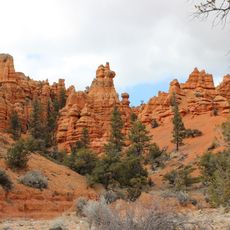
Red Canyon Arch is a natural sandstone formation created through millions of years of erosion by wind and water. The opening is surrounded by rock walls that display distinctive color variations and patterns formed by mineral deposits and weathering.
The arch formed during the Jurassic period when sandstone deposits were laid down and later shaped by natural forces into an opening. Erosion continued across geological time scales to create the structure visible today.
The red rocks reveal layers that have been exposed by wind and water over countless years. Photographers often visit during early morning and late afternoon hours when sunlight brings out the richest tones in the sandstone.
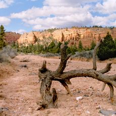
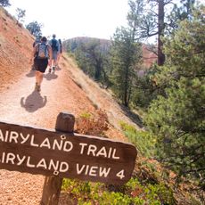
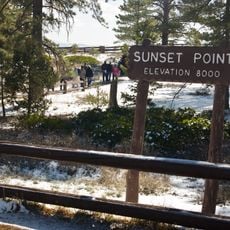
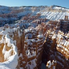
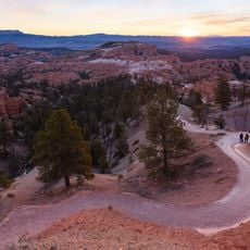
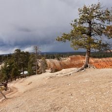
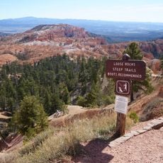
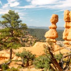
Access is provided through marked hiking trails in Dixie National Forest with starting points near Red Canyon Campground. It helps to bring water and sun protection since the trails are fully exposed to sunlight.
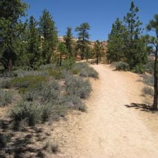
The area around the arch supports a network of mountain biking and horseback riding paths that wind through the surrounding forest landscape. Many visitors combine their visit here with outdoor activities that use the same trail system.
Location: Garfield County
GPS coordinates: 37.74038,-112.29786
Latest update: December 6, 2025 19:03
Utah preserves thousands of years of human history alongside some of North America's most varied geological landscapes. The region contains extensive rock art panels and Ancestral Pueblo ruins, including the 13th-century stone structures at Bears Ears National Monument and the 650-plus petroglyphs...
Red Canyon
2 km
Bryce Canyon Lodge Historic District
17.1 km
Utah Parks Company Service Station
17 km
Old Administration Building
16.8 km
Horse Barn
16.2 km
Old National Park Service Housing Historic District
16.7 km
Bryce Canyon campground comfort stations
16.5 km
Panguitch Historic District
15.2 km
Bryce Wildlife Adventure
9.9 km
Loop C Comfort Station
16.4 km
Loop D Comfort Station
16.4 km
Bryce Canyon Visitor Center
15.9 km
Fairyland Loop Trail
17.9 km
North Campground
16.4 km
Sunset Point Overlook
17.5 km
Sunset Cliffs
15.3 km
Rim Trail
17.2 km
Thor's Hammer
17.7 km
Silent City
17.6 km
Sunrise Point
17.2 km
Mather Plaque in Bryce Canyon National Park
15.9 km
Casto Canyon
5.7 km
Inspiration Point Overlook
17.9 km
Tower Bridge
18.1 km
Sunset Point
17.5 km
The Sentinel
17.7 km
Queen Victoria
17.8 km
Losee Canyon
4.6 kmVisited this place? Tap the stars to rate it and share your experience / photos with the community! Try now! You can cancel it anytime.
Discover hidden gems everywhere you go!
From secret cafés to breathtaking viewpoints, skip the crowded tourist spots and find places that match your style. Our app makes it easy with voice search, smart filtering, route optimization, and insider tips from travelers worldwide. Download now for the complete mobile experience.
A unique approach to discovering new places❞
— Le Figaro
All the places worth exploring❞
— France Info
A tailor-made excursion in just a few clicks❞
— 20 Minutes