Enable Location

We need your location to show you interesting places around you

Discover nearby places

Find interesting locations and hidden gems around you

Precise directions

Get accurate directions and distances to places

Your location is never shared with other users. It's only used when you tap the location button.

Jetée Thiers

Log in to your account

Start exploring — it's free

Trusted by travelers worldwide

Continue with Google
Continue with Apple
or

We will send you a code to connect

By continuing, you accept our Terms and Conditions and our Privacy Policy

Check your inbox

We've sent a pincode in your inbox. Please enter the code below.

Jetée Thiers

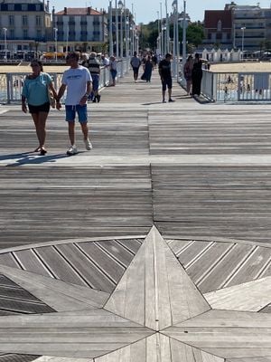
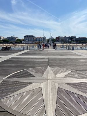
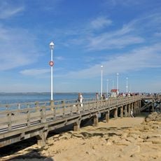
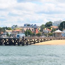
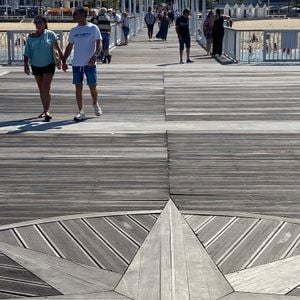
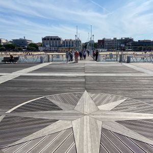
Jetée Thiers, Maritime pier in Arcachon, France

Description

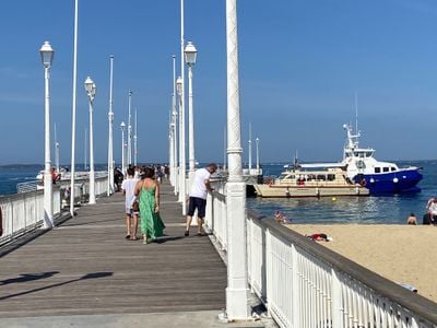
Jetée Thiers is a pier extending into Arcachon Bay with wooden decks that provide access to the water. The structure serves multiple vessels and connects the harbor area to different parts of the bay.

History

The pier was constructed in 1903 and became a key transportation hub for the town. Its development marked a turning point in connecting Arcachon with surrounding coastal areas.

Culture

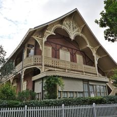
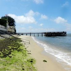
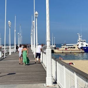
The pier draws locals and visitors who appreciate the waterfront and the region's maritime traditions. It reflects the town's identity as a harbor settlement where fishing boats and tour vessels share the same waters.

Practical

The pier is accessible year-round and serves as the launch point for boat trips. Several berths accommodate different operators, so check which vessel is at which spot before boarding.

Did you know?

On quieter days, you can watch fishing operations from the wooden platforms, a practice that remains central to daily harbor life. This view reveals how traditional work still shapes the port's rhythm.

Location
Inception
1903
GPS coordinates
44.66481,-1.16877
Latest update
December 6, 2025 19:08

AroundUs brings together thousands of curated places, local tips, and hidden gems, enriched daily by 60,000 contributors worldwide. Discover all places nearby (Arcachon).

Photography around Bassin d'Arcachon: beaches, oyster villages, Dune du Pilat

The Bassin d'Arcachon covers 155 square kilometers along the French Atlantic coast and offers numerous subjects for photography. The Dune du Pilat rises 110 meters above sea level and forms the tallest sand dune in Europe. Oyster farming villages such as Gujan-Mestras, L'Herbe, and Le Canon display...

« Jetée Thiers - Maritime pier in Arcachon, France » is provided by Around Us (aroundus.com). Images and texts are derived from Wikimedia project under a Creative Commons license. You are allowed to copy, distribute, and modify copies of this page, under the conditions set by the license, as long as this note is clearly visible.

Discover hidden gems everywhere you go!

From secret cafés to breathtaking viewpoints, skip the crowded tourist spots and find places that match your style. Our app makes it easy with voice search, smart filtering, route optimization, and insider tips from travelers worldwide. Download now for the complete mobile experience.

Around Us App Screenshot

A unique approach to discovering new places

Le Figaro

All the places worth exploring

France Info

A tailor-made excursion in just a few clicks

20 Minutes

Around Us
Travel Guide & Maps
Download

Send to your phone

QR Code
1

Open the camera app on your mobile.

2

Point at the QR code with your camera. A notification will appear.

3

Tap the notification to open the link.