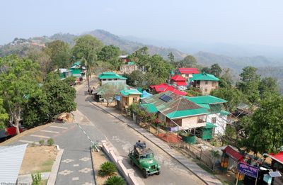
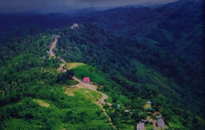
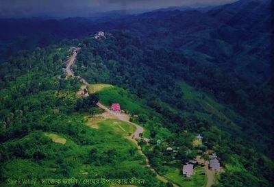
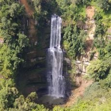
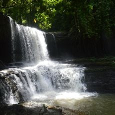
Sajek Valley, Mountain valley and tourist destination in Rangamati District, Bangladesh
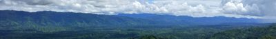
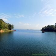
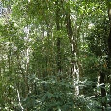
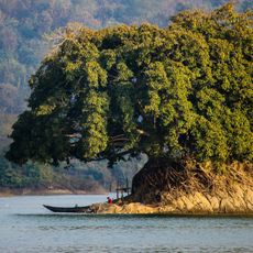
Sajek Valley is a mountain valley in Bangladesh surrounded by rolling hills, thick forests, and rivers flowing through the Kasalong mountain range. The landscape reveals scattered villages, terraced fields, and viewing points where visitors can see across valleys and mountain slopes.
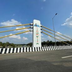
The valley remained isolated from outsiders until roads began developing in the 1960s. A major military road construction spanning the 2000s and 2010s opened the region and transformed it into an accessible tourist destination.
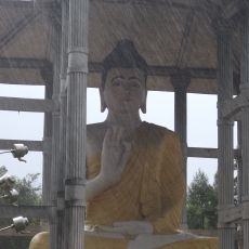
Chakma, Marma, and Tripuri communities inhabit the villages and shape daily rhythms through their traditions and crafts. Markets run by women and family farms create a living culture where visitors encounter people working the land and selling handmade goods.
Travelers reach the valley by four-wheel drive vehicle from Khagrachari, with the journey taking several hours along winding mountain roads. Plan time for the slow, bumpy drive and prepare for unpaved sections where village stops offer glimpses of local routines.
Konglak Para, the highest viewing point, sits just a few kilometers from the border with India's Mizoram state and offers views into the neighboring country. On clear days, visitors standing at this summit can see mountains beyond the border and feel the atmosphere of this international frontier location.
Location: Bagaichhari Upazila
Address: Sajek
Opening Hours: 24/7
GPS coordinates: 23.39092,92.28551
Latest update: December 12, 2025 17:55
Bangladesh extends from the Brahmaputra delta to the hills near the Myanmar border. The country combines historical structures with natural settings that suit photography. In Dhaka, mosques from the 17th century stand near buildings from the 20th century. The coast shows long sandy beaches and small...
Maitri Setu
71.6 km
Dampa Tiger Reserve
5.7 km
Gumti Wildlife Sanctuary
47 km
Vantawng Falls
51 km
Rajiv Gandhi Stadium Mualpui
58.3 km
Alutila Cave
47.6 km
Kohhran Thianghlim
57.3 km
Mizoram State Museum
58.5 km
Tuirihiau falls
50.4 km
Pablakhali Wildlife Sanctuary
24.9 km
Tinap Saitar
59.1 km
Syamsundar Tila
72.7 km
Khagrachhari (subdistrito)
48.9 km
Khagrachari Hill District Council Horticulture Park
45.9 km
Tuirihiau waterfall
50.3 km
Thakurani Tilla
73.9 km
Dengthuama Indoor Stadium
58.1 km
Panchari Shantipur Aranya Kutir
42.9 km
Jampui Hills
73.8 km
New Zealand Para
44.5 km
Montang Valley View Point
70 km
Gate
42.7 km
Why stop
42.6 km
Scenic viewpoint
46.1 km
Martarte Thlan
57 km
Luangmual Centenary Monument
57.2 km
Waterfall
50.5 km
Waterfall
70.7 kmVisited this place? Tap the stars to rate it and share your experience / photos with the community! Try now! You can cancel it anytime.
Discover hidden gems everywhere you go!
From secret cafés to breathtaking viewpoints, skip the crowded tourist spots and find places that match your style. Our app makes it easy with voice search, smart filtering, route optimization, and insider tips from travelers worldwide. Download now for the complete mobile experience.
A unique approach to discovering new places❞
— Le Figaro
All the places worth exploring❞
— France Info
A tailor-made excursion in just a few clicks❞
— 20 Minutes