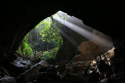
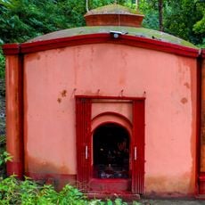
Alutila Cave, Natural cave in Khagrachari District, Bangladesh
Alutila Cave is a natural underground chamber located beneath Alutila Hill with interconnected passages and flowing water features. The interior is carved from limestone and contains varying ceiling heights as visitors move through different sections.
The cave formed over millions of years as underground water dissolved the surrounding limestone and carved out chambers below ground. This slow geological process created the passageways and open spaces visible inside today.
The cave draws visitors from the surrounding region who come to see the natural limestone landscape beneath Alutila Hill. Local communities view it as an important landmark that represents the geological character of their area.
Bring a flashlight or headlamp because the passages are dark, and wear sturdy footwear since the ground is often wet and slippery underfoot. The route through the cave is tight in places and takes roughly thirty minutes to walk from entrance to end.
The underground sections contain varying depth levels that resemble a subway-like tunnel network, showing how water carved passages at different elevations. This layered structure makes each level visually distinct for visitors as they descend and move through the passages.
The community of curious travelers
AroundUs brings together thousands of curated places, local tips, and hidden gems, enriched daily by 60,000 contributors worldwide.