肥豬石
Location: 西貢區 Sai Kung District
GPS coordinates: 22.34244,114.22282
Latest update: November 19, 2025 06:34
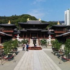
Chi Lin Nunnery
1.8 km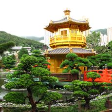
Nan Lian Garden
1.9 km
Po Kong Village Road Park
1.7 km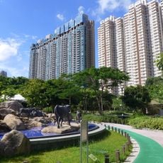
Ngau Chi Wan Park
1.2 km
Aria
1 km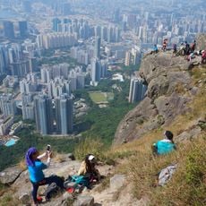
Suicide Cliff
461 m
Diamond Hill Columbarium
1.6 km
Tate's Cairn
1.8 km
St. Joseph's Home for the Aged
1.5 km
Jordan Valley Reservoir
1.8 km
Hammer Hill Park
1.7 km
Tung Shan
1.1 km
Sam Shan Kwok Wong Temple
1.8 km
Bun Ha Tung
1.4 km
Cham Tin Shan
996 m
Suicide Wall
457 m
Kwai Au Shan
1.9 km
Work of art, sculpture
1.8 km
Shark Rock
1.1 km
Hollow Tree
1.2 km
Jehovahjireh Concert Hall
1.8 km
仙人曬靴石
613 m
飛鵝山觀景台 Kowloon Peak Viewing Point
1.2 km
飛鵝山觀景台 Kowloon Peak Viewing Point
1.2 km
歷史觀景台 Historical Viewing Platform
1.7 km
Scenic viewpoint
1.8 km
Monument
983 m
Ruins
1.8 kmReviews
Visited this place? Tap the stars to rate it and share your experience / photos with the community! Try now! You can cancel it anytime.
Discover hidden gems everywhere you go!
From secret cafés to breathtaking viewpoints, skip the crowded tourist spots and find places that match your style. Our app makes it easy with voice search, smart filtering, route optimization, and insider tips from travelers worldwide. Download now for the complete mobile experience.

A unique approach to discovering new places❞
— Le Figaro
All the places worth exploring❞
— France Info
A tailor-made excursion in just a few clicks❞
— 20 Minutes