Enable Location

We need your location to show you interesting places around you

Discover nearby places

Find interesting locations and hidden gems around you

Precise directions

Get accurate directions and distances to places

Your location is never shared with other users. It's only used when you tap the location button.

Tung Shan

Log in to your account

Start exploring — it's free

Trusted by 62,883 travelers worldwide

Continue with Google
Continue with Apple
or

We will send you a code to connect

By continuing, you accept our Terms and Conditions and our Privacy Policy

Check your inbox

We've sent a pincode in your inbox. Please enter the code below.

Tung Shan
Discussion Reviews 1 Photos
3k Popularity

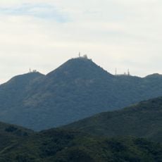
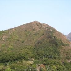
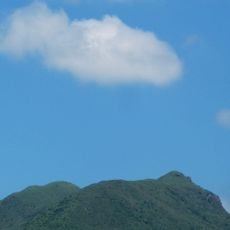
Tung Shan, Mountain summit in Sai Kung District, Hong Kong.

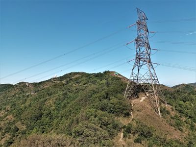
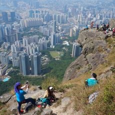
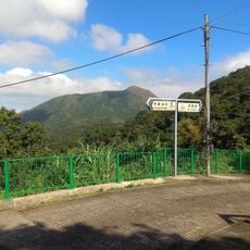
Tung Shan is a mountain summit reaching 544 meters (1,785 feet) in Sai Kung District on Hong Kong's eastern side. The peak sits between Kowloon Peak and Shatin Pass Road, with multiple rocky outcrops providing different vantage points from the top.

The mountain received its name from its middle position between neighboring peaks, making it a natural boundary marker in Hong Kong's geography. This central location helped establish it as a key reference point in the eastern region.

The summit attracts photographers who position themselves at rocky outcrops to capture views across the Kowloon Peninsula and Sai Kung's rural landscape. This location serves as a gathering point for people seeking to document Hong Kong's contrasting urban and countryside scenery.

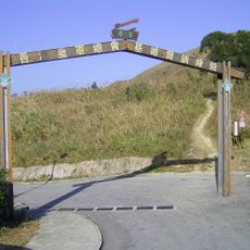
The trailhead is accessible by minibus 1A from Diamond Hill MTR station, getting off at Fei Ngo Shan Road. The climb is relatively short, though the path can become slippery when wet.

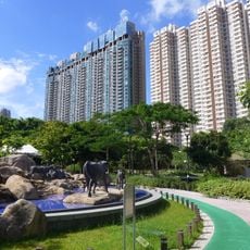
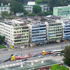
From the peak, visitors experience a striking contrast in one viewpoint: urban skyscrapers of the Kowloon Peninsula on one side shift to quiet fields and villages of Sai Kung on the other. This duality captured from a single location shows how dramatically the landscape changes across short distances in Hong Kong.

The community of curious travelers

AroundUs brings together thousands of curated places, local tips, and hidden gems, enriched daily by 60,000 contributors worldwide.

Start exploring
Location
Elevation above the sea
544 m
GPS coordinates
22.35261,114.22172
Latest update
December 12, 2025 12:05
« Tung Shan - Mountain summit in Sai Kung District, Hong Kong » is provided by Around Us (aroundus.com). Images and texts are derived from Wikimedia project under a Creative Commons license. You are allowed to copy, distribute, and modify copies of this page, under the conditions set by the license, as long as this note is clearly visible.

Discover hidden gems everywhere you go!

From secret cafés to breathtaking viewpoints, skip the crowded tourist spots and find places that match your style. Our app makes it easy with voice search, smart filtering, route optimization, and insider tips from travelers worldwide. Download now for the complete mobile experience.

Around Us App Screenshot

A unique approach to discovering new places

Le Figaro

All the places worth exploring

France Info

A tailor-made excursion in just a few clicks

20 Minutes

Around Us
Travel Guide & Maps
Download

Send to your phone

QR Code
1

Open the camera app on your mobile.

2

Point at the QR code with your camera. A notification will appear.

3

Tap the notification to open the link.