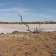
Ling Trig
Location: Murray-Sunset
Location: Rural City of Mildura
GPS coordinates: -35.03154,141.46660
Latest update: November 21, 2025 21:18
Murray-Sunset National Park
28.3 km
Wyperfeld National Park
70 km
Big Desert Wilderness Park
51.9 km
Peebinga Conservation Park
59.1 km
Murrayville railway station
36.1 km
Kow Plains Homestead
24.2 km
Former Murrayville Consolidated School
36.8 km
Hopping Mouse Hill
64.5 km
Crater
64.6 km
White Springs Lookout
40.1 km
Patchewollock Golf Course
68.7 km
Pinnaroo Wetlands / Pinnaroo Animal Park & Bird Aviary
57 km
Milmed Rock
70.2 km
O'Sullivan Lookout (approx)
49.5 km
Pinnaroo Golf Course
57.1 km
Mount Crozier Lookout
25.7 km
Mount Jess Lookout
33 km
Underbool Golf Course
34.3 km
White Springs Lookout
40.3 km
Big Dune
46.6 km
Scenic viewpoint
40.9 km
Bracky Well disused
67.3 km
Livestock
23.8 km
Green Opal Mine
1.3 km
Pioneer Memorial
35.2 km
Ruins
60.8 km
Ruins, private road
62.3 km
Railway Barracks
60 kmReviews
Visited this place? Tap the stars to rate it and share your experience / photos with the community! Try now! You can cancel it anytime.
Discover hidden gems everywhere you go!
From secret cafés to breathtaking viewpoints, skip the crowded tourist spots and find places that match your style. Our app makes it easy with voice search, smart filtering, route optimization, and insider tips from travelers worldwide. Download now for the complete mobile experience.

A unique approach to discovering new places❞
— Le Figaro
All the places worth exploring❞
— France Info
A tailor-made excursion in just a few clicks❞
— 20 Minutes