The Canyon
Location: Sandoval County
GPS coordinates: 35.23703,-106.93642
Latest update: October 12, 2024 08:11
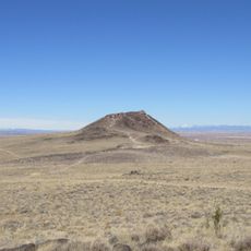
Vulcan
18.4 km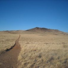
Black Volcano
19 km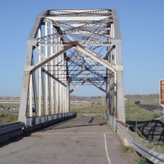
Rio Puerco Bridge
22.7 km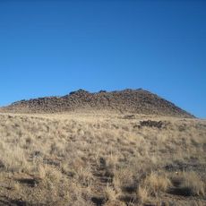
JA volcano
19.3 km
Tamayameh Kah Sta Mah
23.5 km
Mariposa Basin Park
23.5 km
Esther Bone Memorial Library
24.5 km
Standing Rock
20.9 km
Petroglyph National Monument Visitor Center
23.2 km
Amphitheater
23.1 km
Compass Rose
15.8 km
Needalocker Hill/Bart's Rock
1.4 km
The Wall
1.2 km
Dos Amigos
1.2 km
(Little) Snoopy Rock
1.1 km
Scenic viewpoint
21.8 km
Dragon's Back/(Big) Snoopy
970 m
Desert Greens Golf Course
22.9 km
Rio Rancho Badlands Overlook
22.7 km
Mesa Overlook
511 m
Moon Rocks
760 m
Rio Puerco Rock Formations
5.5 km
Crystal Hill
415 m
Ladera Golf Course
24.1 km
Rams
24.4 km
Fossil Hill
355 m
Work of art, sculpture
24.8 km
Work of art, sculpture
24.9 kmReviews
Visited this place? Tap the stars to rate it and share your experience / photos with the community! Try now! You can cancel it anytime.
Discover hidden gems everywhere you go!
From secret cafés to breathtaking viewpoints, skip the crowded tourist spots and find places that match your style. Our app makes it easy with voice search, smart filtering, route optimization, and insider tips from travelers worldwide. Download now for the complete mobile experience.

A unique approach to discovering new places❞
— Le Figaro
All the places worth exploring❞
— France Info
A tailor-made excursion in just a few clicks❞
— 20 Minutes