Lahar Viewpoint Interpretive Site
Location: Skamania County
GPS coordinates: 46.15979,-122.09569
Latest update: October 26, 2025 22:06
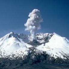
Mount St. Helens
8.5 km
Ape Canyon
4.7 km
Crater Glacier
8.2 km
Swift Reservoir
13.3 km
Scenic viewpoint
9.9 km
Scenic viewpoint
14.2 km
Lava Canyon Interpretive Site
902 m
Moss Spring Observation Site
414 m
Windy Ridge Interpretive Site
10.5 km
Ape Cave Interpretive Site
10.7 km
Scenic viewpoint
7.9 km
Scenic viewpoint
932 m
Scenic viewpoint
952 m
Scenic viewpoint
1.2 km
Trail Of Two Forests Interpretive Site
11.3 km
Ape Canyon Trailhead
670 m
Skylight
10.4 km
Windy Ridge Viewpoint
10.5 km
Cedar Creek Viewpoint
12.5 km
Harmony Lake Viewpoint
10.8 km
Scenic viewpoint
14.6 km
Scenic viewpoint
13.5 km
Scenic viewpoint
14.4 km
Scenic viewpoint
14.1 km
Scenic viewpoint
10.9 km
Scenic viewpoint
11.3 km
Scenic viewpoint
12 km
Scenic viewpoint
9.6 kmReviews
Visited this place? Tap the stars to rate it and share your experience / photos with the community! Try now! You can cancel it anytime.
Discover hidden gems everywhere you go!
From secret cafés to breathtaking viewpoints, skip the crowded tourist spots and find places that match your style. Our app makes it easy with voice search, smart filtering, route optimization, and insider tips from travelers worldwide. Download now for the complete mobile experience.

A unique approach to discovering new places❞
— Le Figaro
All the places worth exploring❞
— France Info
A tailor-made excursion in just a few clicks❞
— 20 Minutes