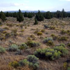
OROC Brothers Launchsite
Location: Deschutes County
Website: http://www.oregonrocketry.org/
Website: http://oregonrocketry.org
GPS coordinates: 43.80093,-120.65013
Latest update: October 12, 2024 08:34
Oregon Badlands Wilderness
38.3 km
Oregon Desert Trail
41.3 km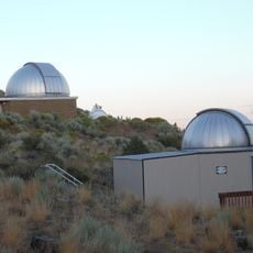
Pine Mountain Observatory
23.4 km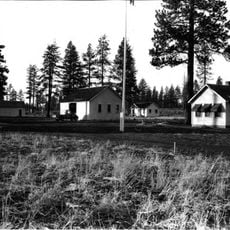
Cabin Lake Guard Station
47.7 km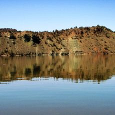
Prineville Reservoir Wildlife Area
38.8 km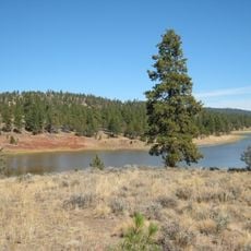
Antelope Flat Reservoir
30.6 km
East Lava Field
38.1 km
Newberry Crater
47.6 km
Juniper Point
36.2 km
Pringle Flat Reservoir
19.6 km
Chicago Pond
46.8 km
Reynolds Pond
40.9 km
Bull Lake Waterhole
44.5 km
Houston Reservoir Number Two
8.3 km
Windy Point
33.4 km
Rodman Rim
13 km
Prineville Reservoir State Park
37.6 km
Central Oregon Canal
42.8 km
Antelope Reservoir Recreation Site
30.4 km
Aspen Butte
29.6 km
North Butte Waterhole
22.3 km
Scenic viewpoint
23.3 km
Dry River
31.6 km
Cinder Hill Viewpoint
44.1 km
Scenic viewpoint
34.8 km
Eagle's Nest Ampitheather
37.2 km
Scenic viewpoint
35.1 km
Work of art, statue
4.4 kmReviews
Visited this place? Tap the stars to rate it and share your experience / photos with the community! Try now! You can cancel it anytime.
Discover hidden gems everywhere you go!
From secret cafés to breathtaking viewpoints, skip the crowded tourist spots and find places that match your style. Our app makes it easy with voice search, smart filtering, route optimization, and insider tips from travelers worldwide. Download now for the complete mobile experience.

A unique approach to discovering new places❞
— Le Figaro
All the places worth exploring❞
— France Info
A tailor-made excursion in just a few clicks❞
— 20 Minutes