Chest opened
+${chestReward.xp} XP
Explorer
NOUVEAU ×${chestReward.collectible.quantity}
tapez pour fermer
Chest locked

Open chests in the app

Around Us is built for your phone — chests unlock when you walk, explore and capture nearby places.

Enable Location

We need your location to show you interesting places around you

Discover nearby places

Find interesting locations and hidden gems around you

Precise directions

Get accurate directions and distances to places

Your location is never shared with other users. It's only used when you tap the location button.

Log in to your account

Start exploring — it's free

Trusted by 72,901 travelers worldwide

Continue with Google
Continue with Apple
or

We will send you a code to connect

By continuing, you accept our Terms and Conditions and our Privacy Policy

Check your inbox

We've sent a pincode in your inbox. Please enter the code below.

Oregon Desert Trail
Discussion Reviews Photo
3.6k Popularity

Oregon Desert Trail, Desert trail system in Oregon, United States.

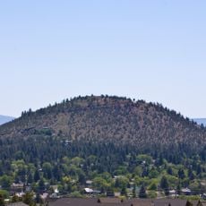
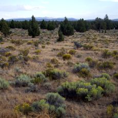
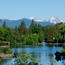
The Oregon Desert Trail is a 750-mile network extending from Oregon Badlands Wilderness to Lake Owyhee Reservoir across varied landscapes. The route passes through grasslands, subalpine zones, and deep river canyons with shifting elevations throughout.

The Oregon Natural Desert Association established this route in the early 2000s under the guidance of Brent Fenty to highlight eastern Oregon. The project grew from efforts to bring attention to this remote and often overlooked region.

The trail passes through territory where local ranchers and residents have adapted to remote desert life for generations. Visitors experience how people maintain traditional practices and deep connections to this rugged landscape.

Successful travel requires strong navigation skills and careful water planning since the route combines existing trails, old roads, and cross-country sections. The terrain offers few standard trail markers, so preparation and self-reliance are essential.

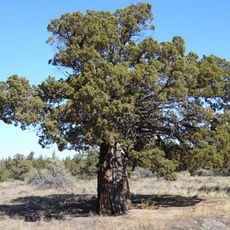
Hikers encounter pronghorn antelope, wild horses, and mule deer roaming across the landscape along the way. These wildlife encounters reveal the biological diversity hidden within this seemingly barren region.

The community of curious travelers

AroundUs brings together thousands of curated places, local tips, and hidden gems, enriched daily by 60,000 contributors worldwide.

Start exploring
Location
GPS coordinates
44.04550,-121.03800
Latest update
December 12, 2025 07:52
Around this place
Pilot Butte
United States of America

Pilot Butte

19.7 km
Les Schwab Amphitheater
United States of America

Les Schwab Amphitheater

22.4 km
Oregon Badlands Wilderness
United States of America

Oregon Badlands Wilderness

5.1 km
Mirror Pond
United States of America

Mirror Pond

22.2 km
Old St. Francis School
United States of America

Old St. Francis School

22.1 km
Vince Genna Stadium
United States of America

Vince Genna Stadium

21 km
N. P. Smith Pioneer Hardware Store
United States of America

N. P. Smith Pioneer Hardware Store

22.1 km
Tower Theatre
United States of America

Tower Theatre

22.2 km
Thomas McCann House
United States of America

Thomas McCann House

22.5 km
Redmond–Bend Juniper State Scenic Corridor
United States of America

Redmond–Bend Juniper State Scenic Corridor

22.4 km
O'Kane Building
United States of America

O'Kane Building

22.1 km
George Palmer and Dorothy Binney Putnam House
United States of America

George Palmer and Dorothy Binney Putnam House

22.4 km
Reid School
United States of America

Reid School

22.3 km
Old Bend High School
United States of America

Old Bend High School

22.3 km
Goodwillie–Allen House
United States of America

Goodwillie–Allen House

22.2 km
Sun Mountain Fun Center
United States of America

Sun Mountain Fun Center

21.6 km
Charles Boyd Homestead Group
United States of America

Charles Boyd Homestead Group

21.6 km
Deschutes Public Library Administration Building
United States of America

Deschutes Public Library Administration Building

22.3 km
Congress Apartments
United States of America

Congress Apartments

22.8 km
Rock O' the Range Bridge
United States of America

Rock O' the Range Bridge

21.6 km
Evan Andreas Sather House
United States of America

Evan Andreas Sather House

22.4 km
Old U.S. Post Office
United States of America

Old U.S. Post Office

22.2 km
Ponderosa Skatepark
United States of America

Ponderosa Skatepark

19.8 km
B. A. and Ruth Stover House
United States of America

B. A. and Ruth Stover House

22.4 km
Robert D. Moore House
United States of America

Robert D. Moore House

22.5 km
Bend Whitewater Park
United States of America

Bend Whitewater Park

22.7 km
Emil and Ottilie Wienecke House
United States of America

Emil and Ottilie Wienecke House

22.9 km
Peter Byberg House
United States of America

Peter Byberg House

22.6 km
Show the full map
Reviews
Share your experience

No review yet

Discussions
Start a discussion...

No discussion yet

« Oregon Desert Trail - Desert trail system in Oregon, United States » is provided by Around Us (aroundus.com). Images and texts are derived from Wikimedia project under a Creative Commons license. You are allowed to copy, distribute, and modify copies of this page, under the conditions set by the license, as long as this note is clearly visible.

Discover hidden gems everywhere you go!

From secret cafés to breathtaking viewpoints, skip the crowded tourist spots and find places that match your style. Our app makes it easy with voice search, smart filtering, route optimization, and insider tips from travelers worldwide. Download now for the complete mobile experience.

Around Us App Screenshot

A unique approach to discovering new places

Le Figaro

All the places worth exploring

France Info

A tailor-made excursion in just a few clicks

20 Minutes

Around Us
Travel Guide & Maps
Download

Send to your phone

QR Code
1

Open the camera app on your mobile.

2

Point at the QR code with your camera. A notification will appear.

3

Tap the notification to open the link.