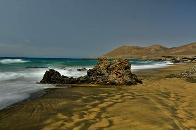
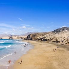
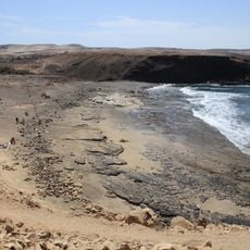
Playa de la Solapa, Beach on eastern coast of Fuerteventura, Spain.
Playa de la Solapa is a beach on Fuerteventura's eastern coast covered in dark sand and bordered by natural rock formations. Small coves offer clear shallow water and tide pools, creating the beach's defining character.
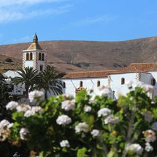
Fishing and piracy shaped this coastal region for centuries, with nearby Ajuy serving as one of the island's earliest settlements. The area's maritime past continues to influence how people use it.
Fishermen work along this stretch using methods that have remained largely unchanged for generations. Their daily presence and simple boats reflect how locals have long relied on the sea.
The beach is reachable by unpaved road from Pájara, about 3 kilometers away, leading to a small parking area. A car is helpful, and visiting at low tide gives the best chance to explore the rock pools and coves.
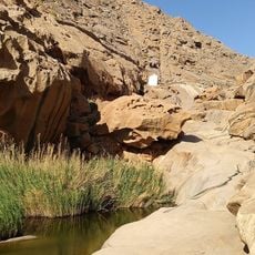
Large rock formations detach from the shoreline when the tide goes out, creating small island-like formations surrounded by water and teeming with sea creatures. These temporary underwater worlds change appearance depending on water levels.
Address: Playa de la Solapa, Spain
GPS coordinates: 28.36432,-14.16690
Latest update: December 6, 2025 19:02
Fuerteventura, the second largest island in the Canary Islands, is characterized by its diverse landscapes and notable geological features. The island houses spectacular formations such as the white dunes of Corralejo Natural Park, extending over more than 10 kilometers, the 70-million-year-old Ajuy...
Ajuy Caves
4.5 km
Oasis Park
20 km
Parque Rural de Betancuria
11.3 km
Iglesia de Nuestra Señora de Regla
6 km
Morro Velosa
14.1 km
Iglesia de Nuestra Señora (Antigua (Fuerteventura))
16.3 km
Tuineje church
12.3 km
Barranco de las Peñitas
8.4 km
Molino de Antigua
16.8 km
Windmill at Calle Isla De Montaña Clara
15.3 km
Windmill in Llanos de la Concepción (Four-sail)
18.4 km
Windmill at La Corte
15.9 km
Windmill in Llanos de la Concepción
17.9 km
Ermita de Nuestra Senora de Guadalupe
13.4 km
Windmill of Durazno
15.7 km
Windmill at Lugar Teguitar
15.6 km
Windmill at Calle General Moscardol
15.1 km
Windmill in Tiscamanita
12.9 km
Iglesia de la Inmaculada Concepción
20.2 km
Guise and Ayose
13.8 km
Molino de Tiscamanita
12.7 km
Viejo Rey Beach
18 km
Conjunto Histórico Artístico la Villa
12.7 km
Astronomical viewpoint Sicasumbre
8.5 km
Biblioteca Pública Municipal de Pájara
6.2 km
Playa de la Pared
17.1 km
Biblioteca Pública Municipal de Antigua
16.2 km
Mirador Velosa
13.9 kmVisited this place? Tap the stars to rate it and share your experience / photos with the community! Try now! You can cancel it anytime.
Discover hidden gems everywhere you go!
From secret cafés to breathtaking viewpoints, skip the crowded tourist spots and find places that match your style. Our app makes it easy with voice search, smart filtering, route optimization, and insider tips from travelers worldwide. Download now for the complete mobile experience.
A unique approach to discovering new places❞
— Le Figaro
All the places worth exploring❞
— France Info
A tailor-made excursion in just a few clicks❞
— 20 Minutes