Parker Creek
Location: Stanage
Location: Livingstone Shire
GPS coordinates: -22.14371,150.00845
Latest update: November 5, 2025 14:02

Broad Sound Islands National Park
32.6 km
South Island National Park
54.8 km
West Hill National Park
64.3 km
Northumberland Islands National Park
64 km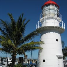
Pine Islet Light
58.3 km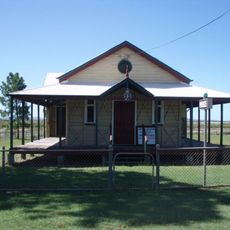
St Lawrence Police Station
54.3 km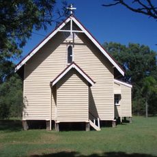
Christ Church Anglican Church, St Lawrence
53.4 km
North East Island National Park
63.1 km
Meatworks and Wharf Site, St Lawrence
52.5 km
Percy Isles National Park
59.4 km
Pine Islet Light
58.3 km
Three Mile Beach
59.4 km
Sand Bank Bay (10)
10.4 km
Mooly Creek (East 2)
48.4 km
3 Mile Beach
61.4 km
Oyster Fence Beach
54.8 km
Oyster Fence (West)
53.2 km
Little Creek (East)
51.6 km
Little Creek Beach (West)
50 km
Shoalwater Creek Beach
64.9 km
Mooly Creek (East 1)
47 km
Dry Creek
51.5 km
Scenic viewpoint
50.1 km
The Lagoon
60 km
View of South Percy Island
59.2 km
Scenic viewpoint
55.4 km
Memorial
64.1 km
Broadsound Centenary Pavilion
54.5 kmReviews
Visited this place? Tap the stars to rate it and share your experience / photos with the community! Try now! You can cancel it anytime.
Discover hidden gems everywhere you go!
From secret cafés to breathtaking viewpoints, skip the crowded tourist spots and find places that match your style. Our app makes it easy with voice search, smart filtering, route optimization, and insider tips from travelers worldwide. Download now for the complete mobile experience.

A unique approach to discovering new places❞
— Le Figaro
All the places worth exploring❞
— France Info
A tailor-made excursion in just a few clicks❞
— 20 Minutes