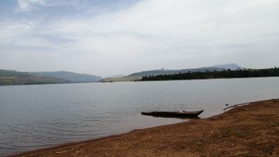
Lac de Samaya, Lake near Kindia, Guinea
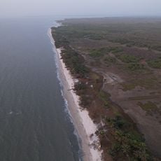
Lac de Samaya is a reservoir beneath Mount Gangan cliffs with multiple water arms connecting scattered villages in the Kindia region. The lake sits within canyon walls and features varying depths across its different sections.
The dam was built in the 1980s and created a water barrier that separated many villages in the area. This division permanently changed how people traveled and traded between settlements.
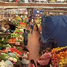
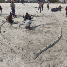
Local villagers gather at the Sunday market by the water's edge to sell fruits and vegetables brought across by colorful canoes. This routine connects the scattered settlements around the lake through trade and regular social contact.
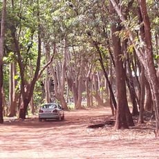
The drive takes about one hour from Friguiagbé starting at a fuel station, with four-wheel-drive vehicles recommended due to rough road conditions. Hiring a local guide can help you find the best access points and safe routes around the water.
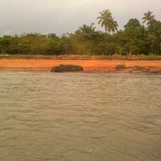
Hidden within a canyon sits an abandoned colonial agronomic research station slowly reclaimed by nature. Two monasteries nearby, including one run by Benedictine nuns, offer overnight stays for visitors.
Location: Samaya
Address: Unnamed Road, 3X8R+HV7, Samaya, Guinea
Phone: +224621815202
GPS coordinates: 10.06641,-13.00782
Latest update: December 6, 2025 19:10
Guinea is home to natural sites such as Mount Nimba, the Haut Niger Park, and the Los Islands. Religious buildings include the Grand Mosque of Conakry and the Sainte-Marie Cathedral. The country has several waterfalls, including Voile de la Mariée and Kambadaga. National museums present Guinean history and culture. Traditional markets and Atlantic beaches complete the tourism offerings.
General Lansana Conté Stadium
83.8 km
Télimélé
92.8 km
Grand Mosque of Conakry
95 km
Palais du Peuple
96.6 km
Outamba-Kilimi National Park
112.5 km
Conakry National Museum
99.1 km
Stade Petit Sory
84 km
Marché Madina
92.9 km
Monument du 22 Novembre 1970
96.4 km
8 November Bridge
95.9 km
Marché du Niger
98.6 km
Plage de Sôrô
104.2 km
Tayaki Beach
79 km
Forêt de Dalaba
108.7 km
Plage de Bénarès
85.6 km
Forêt classé de Kakimbo
88.3 km
Kouratier
106.8 km
Plage de Kassa
104.8 km
Plage de Roume
108.8 km
Cascade de Tabouna
20.8 km
Mosquée Turque de Koloma
86.2 km
Villa de Dalaba
106.3 km
Bluezone de Kaloum
98.4 km
Case à palabres de Dalaba
106.3 km
Cascade de la Soumba
51.6 km
植物園
95.4 km
Cascade du Voile de la Mariée
25 km
Presqu'île de Camayenne
93.4 kmReviews
Visited this place? Tap the stars to rate it and share your experience / photos with the community! Try now! You can cancel it anytime.
Discover hidden gems everywhere you go!
From secret cafés to breathtaking viewpoints, skip the crowded tourist spots and find places that match your style. Our app makes it easy with voice search, smart filtering, route optimization, and insider tips from travelers worldwide. Download now for the complete mobile experience.
A unique approach to discovering new places❞
— Le Figaro
All the places worth exploring❞
— France Info
A tailor-made excursion in just a few clicks❞
— 20 Minutes