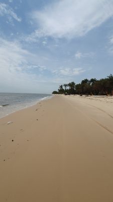
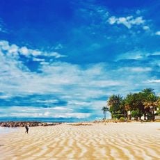
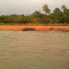
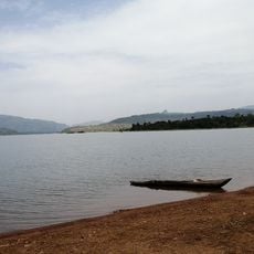
Tayaki Beach, Beach stretch in Ratoma, Guinea
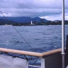
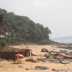
Tayaki Beach is a white sand beach along the Atlantic coast in the Ratoma region of Guinea. The shoreline offers an open, quiet landscape away from Conakry's urban areas, with fishing villages and salt production areas nearby.
The area developed through generations of fishermen and farmers who established their communities here and created traditional salt harvesting methods. This long-standing settlement shaped the coastal landscape and demonstrates how people have worked with the region's natural resources over time.
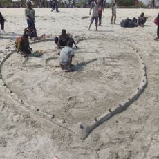
Local fishermen work daily at this beach, selling their catches to visitors and traders, while nearby residents harvest salt using hand-made methods. These daily activities shape the rhythm of life here and show how the community depends on the sea and surrounding land.
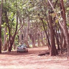
The beach is reached by walking about 90 minutes across rice fields and wetland areas with uneven, muddy ground. Visitors should wear sturdy shoes and plan their visit when weather conditions are favorable to navigate the path safely.
The village near the beach survives without running water, electricity, or medical services, despite being located on the coast near the capital. This isolation reveals how remote some settlements remain, even when situated close to Conakry.
Location: Ratoma
Address: P92H+98, Conakry, Guinea
Phone: +224621996423
GPS coordinates: 9.69499,-13.62135
Latest update: December 6, 2025 17:48
Guinea is home to natural sites such as Mount Nimba, the Haut Niger Park, and the Los Islands. Religious buildings include the Grand Mosque of Conakry and the Sainte-Marie Cathedral. The country has several waterfalls, including Voile de la Mariée and Kambadaga. National museums present Guinean history and culture. Traditional markets and Atlantic beaches complete the tourism offerings.
Cotton Tree
141 km
General Lansana Conté Stadium
7.9 km
Grand Mosque of Conakry
19.3 km
Palais du Peuple
21 km
Conakry National Museum
23.3 km
Stade Petit Sory
7.8 km
Marché Madina
17.7 km
Monument du 22 Novembre 1970
20.8 km
8 November Bridge
20.2 km
Sierra Leone National Museum
141 km
St. George's Cathedral, Freetown
140.7 km
Marché du Niger
22.6 km
Plage de Sôrô
26.7 km
Cape Sierra Leone Lighthouse
137.9 km
Plage de Bénarès
13.7 km
Forêt classé de Kakimbo
12 km
Plage de Kassa
28.1 km
Plage de Roume
31.7 km
Tor zum alten Kings Yard
140.8 km
Cascade de Tabouna
97.2 km
Mosquée Turque de Koloma
11.6 km
Gateway to the Old King's Yards
140.8 km
Bluezone de Kaloum
22.4 km
Cascade de la Soumba
30.5 km
植物園
19.6 km
Cascade du Voile de la Mariée
96 km
Lac de Samaya
79 km
Presqu'île de Camayenne
17.6 kmReviews
Visited this place? Tap the stars to rate it and share your experience / photos with the community! Try now! You can cancel it anytime.
Discover hidden gems everywhere you go!
From secret cafés to breathtaking viewpoints, skip the crowded tourist spots and find places that match your style. Our app makes it easy with voice search, smart filtering, route optimization, and insider tips from travelers worldwide. Download now for the complete mobile experience.
A unique approach to discovering new places❞
— Le Figaro
All the places worth exploring❞
— France Info
A tailor-made excursion in just a few clicks❞
— 20 Minutes