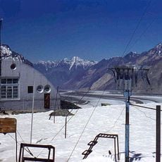
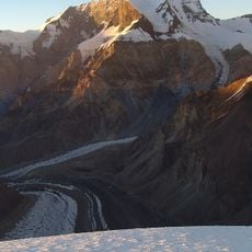
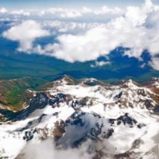
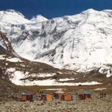
Pamir Mountains, Mountain range in eastern Tajikistan.
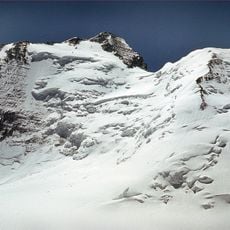
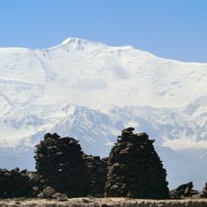
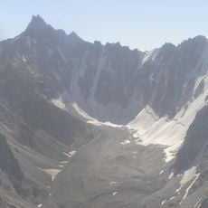
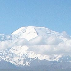
The Pamir Mountains stretch across eastern Tajikistan with peaks exceeding 7 kilometers in elevation. The range features numerous mountain lakes and extensive glaciated terrain that define its high-altitude landscape.
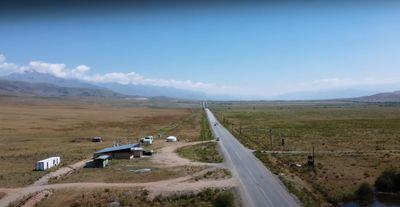
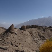
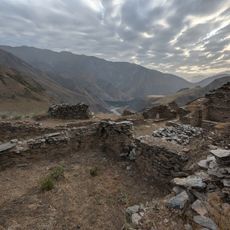
The mountain range was a crucial segment of the Northern Silk Road, connecting ancient Chinese centers with Central Asia. This trade route shaped the development of passes and settlements throughout the region for many centuries.
The valleys are home to several ethnic groups who speak Iranian languages and practice Ismaili Islam. Visitors can observe how these mountain communities maintain their traditions and daily routines in these remote settlements.
The best season for mountain expeditions is July through September when snow melts and trails become passable for trekking. Visitors should prepare for extreme altitude and changeable weather conditions with appropriate gear.
Lake Sarez formed in 1911 when a massive rockslide created a natural dam in the Murgab River valley, trapping water behind it. This deep blue lake is now one of the region's most striking natural features.
Address: Pamir Mountains, Tajikistan
GPS coordinates: 39.00000,72.00000
Latest update: December 6, 2025 17:49
Tajikistan is a land of dramatic contrasts shaped by towering mountains and deep river valleys. The country sits at the crossroads of Central Asia, where ancient trade routes once connected empires and cultures. Today, visitors find themselves in a landscape dominated by peaks that reach beyond 5000...
Ismoil Somoni Peak
6.5 km
Lenin Peak
85.1 km
Fedchenko Glacier
35.7 km
Peak Korzhenevskaya
6.3 km
Pik Garmo
21.9 km
Tajik National Park
58 kmLenin glacier
90.8 km
Kuh-e Safed Khers
128 km
Korzhenevsky Glacier
101.3 km
Dzerzhinsky Peak
77.9 km
Lednik Achyk-Suu
58.3 km
Lednik Atdzhaylo
109.4 km
Lednik Archa-Bashy
97.3 km
Lednik Dugova
92 km
Lednik Yangi-Daban
84.9 km
Lednik Kimisdykty
75.7 km
Lednik Tutek
112.3 km
Lednik Iali-Suu
85.5 km
Lednik Til'be
95.6 km
Rodnik Kur-Bulak
74.1 km
Rodnik Kyrchyn
58.6 km
Rodniki Kyzyl-Bulak
112.1 km
Rodnik Aygyr-Bulak
60.3 kmAk-Suu
111 km
Rodnik Tokmak-Bulak
57.1 km
Rodnik Shor-Bulak (tubud sa Kirgistan, Osh Oblasty, lat 39,48, long 72,27)
57.9 km
Rodnik Kamrak-Bulak
119.6 km
Castle Karon
117.3 kmVisited this place? Tap the stars to rate it and share your experience / photos with the community! Try now! You can cancel it anytime.
Discover hidden gems everywhere you go!
From secret cafés to breathtaking viewpoints, skip the crowded tourist spots and find places that match your style. Our app makes it easy with voice search, smart filtering, route optimization, and insider tips from travelers worldwide. Download now for the complete mobile experience.
A unique approach to discovering new places❞
— Le Figaro
All the places worth exploring❞
— France Info
A tailor-made excursion in just a few clicks❞
— 20 Minutes