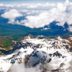
Lenin glacier, Mountain glacier in Trans-Alai range, Kyrgyzstan
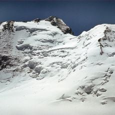
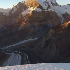
Lenin Glacier is a large expanse of ice in the Trans-Alai range, stretching across a significant portion of the mountain landscape. The ice field displays a white and blue surface carved with deep crevasses that define its terrain.
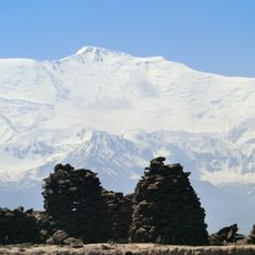
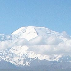
The glacier took its name from the adjacent Lenin Peak, first summited by a German-Russian expedition in 1928. This climb marked a turning point in the exploration of this remote mountain region.
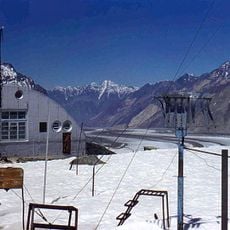
The glacier holds significance for climbers and researchers who track climate shifts and water availability for communities in the valleys below. These ongoing observations shape how people understand changes in the mountain environment.
The glacier is difficult for visitors to reach and requires specialized mountaineering experience and equipment for safe access. Travel during warmer months offers more stable conditions for those attempting to visit.
The ice moves continuously and creates varying patterns and structures across its surface. This constant motion is visible to trained climbers and reveals the dynamic nature of the glacier in striking ways.
GPS coordinates: 39.42003,72.90252
Latest update: December 14, 2025 13:08
Ismoil Somoni Peak
93.1 km
Lenin Peak
8.4 km
Fedchenko Glacier
90.3 km
Peak Korzhenevskaya
86.8 km
Pik Garmo
98.7 km
Abshir Ata Waterfall
94.7 km
Korzhenevsky Glacier
12.1 km
Dzerzhinsky Peak
13.1 km
Lednik Achyk-Suu
38.9 km
Lednik Atdzhaylo
22.2 km
Rodnik Zor-Bulak
99.7 km
Rodnik Chogaden
95.8 km
Rodnik Kara-Bulak (tubud sa Kirgistan, Osh Oblasty)
99.2 km
Rodnik Chong-Tash-Tër
67.3 km
Rodnik Kur-Bulak
27.6 km
Rodnik Kayragach-Mazar
102.4 km
Rodnik Chakman
104.3 km
Rodnik Kosh-Tokoy
102.2 km
Rodnik Kyrchyn
48.5 km
Rodnik Aygyr-Bulak
50.7 km
Rodnik Uzuk-Dzhylga
98.6 km
Rodnik Ak-Terek
87.9 km
Rodniki Kyzyl-Bulak
37.3 km
Rodnik Dam-Bulak
97.9 km
Rodnik Tash-Bulak (tubud sa Kirgistan, Osh Oblasty, lat 40,25, long 72,42)
101 km
Rodnik Kamrak-Bulak
103.1 km
Rodnik Shor-Bulak (tubud sa Kirgistan, Osh Oblasty, lat 40,26, long 72,40)
102.7 km
Rodnik Shor-Bulak (tubud sa Kirgistan, Osh Oblasty, lat 39,48, long 72,27)
55 kmVisited this place? Tap the stars to rate it and share your experience / photos with the community! Try now! You can cancel it anytime.
Discover hidden gems everywhere you go!
From secret cafés to breathtaking viewpoints, skip the crowded tourist spots and find places that match your style. Our app makes it easy with voice search, smart filtering, route optimization, and insider tips from travelers worldwide. Download now for the complete mobile experience.
A unique approach to discovering new places❞
— Le Figaro
All the places worth exploring❞
— France Info
A tailor-made excursion in just a few clicks❞
— 20 Minutes