Enable Location

We need your location to show you interesting places around you

Discover nearby places

Find interesting locations and hidden gems around you

Precise directions

Get accurate directions and distances to places

Your location is never shared with other users. It's only used when you tap the location button.

Trøllkonufingur

Log in to your account

Start exploring — it's free

Trusted by 64,524 travelers worldwide

Continue with Google
Continue with Apple
or

We will send you a code to connect

By continuing, you accept our Terms and Conditions and our Privacy Policy

Check your inbox

We've sent a pincode in your inbox. Please enter the code below.

Trøllkonufingur
Discussion Reviews 1 Photos 1 Collections
20+ Popularity

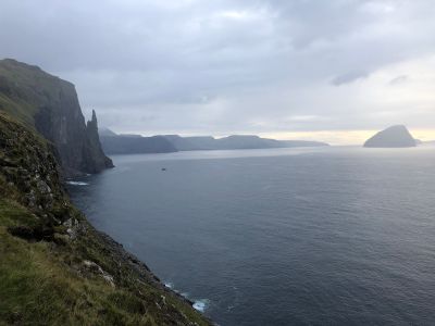
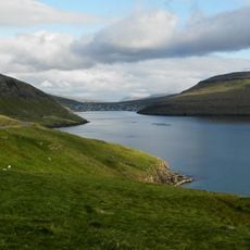
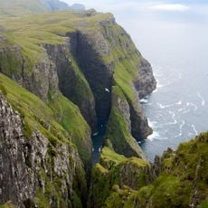
Trøllkonufingur, Rock formation on Vágar Island, Faroe Islands.

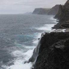
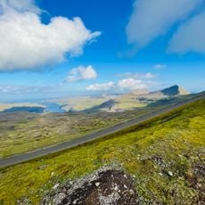
Trøllkonufingur is a vertical rock needle on Vágar Island in the Faroe Islands, rising about 313 meters above sea level. The column stands steeply from the landscape and is framed by the crashing Atlantic coastline.

The rock has long been a landmark on the Faroese coast, but it became infamous in 1844 when a royal visitor climbed the summit and fell to his death while descending. This tragedy turned it into a symbol of the dangers tied to the sea.

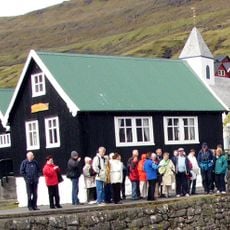
The name means "witch's finger" and comes from an old tale about magic and island folklore. This story shapes how locals and visitors regard the rock today.

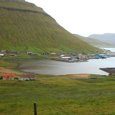
The best starting point is the village of Sandavágur; from there, a walk on foot takes about twenty minutes but can take longer depending on weather and fitness. The coastal route offers no shelter, so prepare for wind and rain.

The rock serves as a breeding ground for Northern fulmars, which nest in the crevices of the monolith and regularly fly across the cliffs. Birdwatching adds an unexpected element to visiting this dramatic site.

The community of curious travelers

AroundUs brings together thousands of curated places, local tips, and hidden gems, enriched daily by 60,000 contributors worldwide.

Start exploring
Address
Trøllkonufingur, 360, Faroe Islands
GPS coordinates
62.05000,-7.08819
Latest update
December 6, 2025 19:09
Faroe Islands: the most photogenic spots, cliffs, waterfalls, and postcard villages

In the Faroe Islands, waterfalls pour into the ocean while villages keep their houses with grass roofs and their natural harbors.

Reviews
Share your experience

No review yet

Discussions
Start a discussion...

No discussion yet

« Trøllkonufingur - Rock formation on Vágar Island, Faroe Islands » is provided by Around Us (aroundus.com). Images and texts are derived from Wikimedia project under a Creative Commons license. You are allowed to copy, distribute, and modify copies of this page, under the conditions set by the license, as long as this note is clearly visible.

Discover hidden gems everywhere you go!

From secret cafés to breathtaking viewpoints, skip the crowded tourist spots and find places that match your style. Our app makes it easy with voice search, smart filtering, route optimization, and insider tips from travelers worldwide. Download now for the complete mobile experience.

Around Us App Screenshot

A unique approach to discovering new places

Le Figaro

All the places worth exploring

France Info

A tailor-made excursion in just a few clicks

20 Minutes

Around Us
Travel Guide & Maps
Download

Send to your phone

QR Code
1

Open the camera app on your mobile.

2

Point at the QR code with your camera. A notification will appear.

3

Tap the notification to open the link.