Enable Location

We need your location to show you interesting places around you

Discover nearby places

Find interesting locations and hidden gems around you

Precise directions

Get accurate directions and distances to places

Your location is never shared with other users. It's only used when you tap the location button.

Dale Ball Trails

Log in to your account

Join the adventure

Create your free account and start exploring (like 60k+ others)

We will send you a code to connect

or
Continue with Google
Continue with Apple
By continuing, you accept our Terms and Conditions and our Privacy Policy

Check your inbox

We've sent a pincode in your inbox. Please enter the code below.

Dale Ball Trails

Dale Ball Trails, Hiking trail network in the foothills north of Santa Fe, New Mexico, United States.

Description

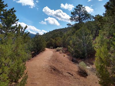
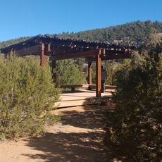
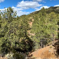
The Dale Ball Trails offer approximately 25 miles (40 kilometers) of natural-surface pathways suitable for hiking and mountain biking across the foothills of the Sangre de Cristo Mountains just outside Santa Fe's city center.

History

The trail network was developed through the vision and efforts of Dale Ball, whose work in planning and construction during the early 2000s established the system with support from municipal agencies, private landowners, and dedicated volunteers.

Culture

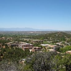
The trails have become an essential part of Santa Fe's outdoor culture, serving residents and visitors as a practical resource for daily exercise, trail running, and recreation within reach of urban neighborhoods and cultural attractions.

Practical

Multiple trailheads provide access along Hyde Park Road, Cerro Gordo Road, Upper Canyon Road, and Camino Cruz Blanca, with parking available at several locations and well-marked junctions with numbered signs and directional maps throughout the system.

Did you know?

The network connects seamlessly to adjacent trail systems including La Piedra, Little Tesuque, Santa Fe Canyon Preserve, Dorothy Stewart, and Atalaya Trails, enabling extended outings and varied route combinations across the regional foothills.

Location
Address
Santa Fe, NM 87501, USA 87501 Santa Fe
Phone
GPS coordinates
35.69040,-105.89592
Latest update
December 1, 2025 20:26

AroundUs brings together thousands of curated places, local tips, and hidden gems, enriched daily by 60,000 contributors worldwide. Discover all places nearby (Santa Fe).

Visit Santa Fe, New Mexico

Santa Fe contains a concentrated collection of historic sites and cultural institutions that reflect the layered history of New Mexico. The city combines Spanish colonial architecture, Native American heritage, and contemporary art across its museums, galleries, and religious buildings. The New...

« Dale Ball Trails - Hiking trail network in the foothills north of Santa Fe, New Mexico, United States » is provided by Around Us (aroundus.com). Images and texts are derived from Wikimedia project under a Creative Commons license. You are allowed to copy, distribute, and modify copies of this page, under the conditions set by the license, as long as this note is clearly visible.

Discover hidden gems everywhere you go!

From secret cafés to breathtaking viewpoints, skip the crowded tourist spots and find places that match your style. Our app makes it easy with voice search, smart filtering, route optimization, and insider tips from travelers worldwide. Download now for the complete mobile experience.

Around Us App Screenshot

A unique approach to discovering new places

Le Figaro

All the places worth exploring

France Info

A tailor-made excursion in just a few clicks

20 Minutes

Around Us
Travel Guide & Maps
Download

Send to your phone

QR Code
1

Open the camera app on your mobile.

2

Point at the QR code with your camera. A notification will appear.

3

Tap the notification to open the link.