よろこび
Location: 日野本町
Location: 日野市
GPS coordinates: 35.68021,139.40344
Latest update: November 17, 2025 03:48

Shinchō-ji
1.8 km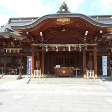
Suwa Shrine, Tachikawa
1.7 km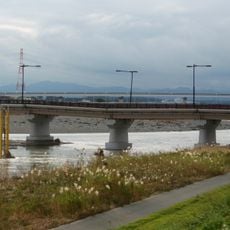
Hino Bridge
920 m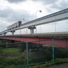
立日橋
682 m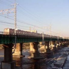
多摩川橋梁 (中央本線)
819 m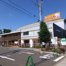
日野市市民の森ふれあいホール
125 m
Shinsengumi Furusato Historical Museum
980 m
安養寺
1.5 km
日野市市民の森スポーツ公園
101 m
立川橋
913 m
Sato Hikogoro Shinsengumi Museum
452 m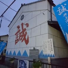
Inoue Genzaburo Museum
569 m
はばたき
4 m
日のいろの 寒き川原に ひらめける 芒 のそよぎ 声のごときもの
1.4 km
ひの煉瓦ホール(日野市民会館)
1.3 km
坂西横穴墓群
1.2 km
桑ハウス
236 m
グリーングリーンハーモニー
907 m
日野の渡し碑
947 m
みどり
3 m
根川貝殻坂橋について
1.4 km
Tomb
1.5 km
Tomb
1.5 km
Tomb
1.5 km
Memorial
1.5 km
Memorial
1.7 km
矢川清流と青柳の府中
1.7 km
Memorial
1.8 kmReviews
Visited this place? Tap the stars to rate it and share your experience / photos with the community! Try now! You can cancel it anytime.
Discover hidden gems everywhere you go!
From secret cafés to breathtaking viewpoints, skip the crowded tourist spots and find places that match your style. Our app makes it easy with voice search, smart filtering, route optimization, and insider tips from travelers worldwide. Download now for the complete mobile experience.

A unique approach to discovering new places❞
— Le Figaro
All the places worth exploring❞
— France Info
A tailor-made excursion in just a few clicks❞
— 20 Minutes