
San Miguel Through Time
Location: San Miguel
Creator: TeamManila Graphic Design Studio
Creator: TeamManila Graphic Design Studio
GPS coordinates: 14.59738,120.99943
Latest update: October 29, 2025 00:08
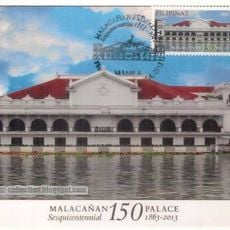
Malacañang Palace
658 m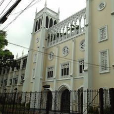
Our Lady of Montserrat Abbey
724 m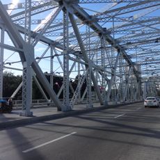
Ayala Bridge
712 m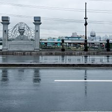
Mabini Bridge
273 m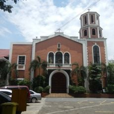
Pandacan Church
702 m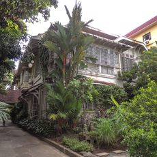
Legarda Ancestral House
599 m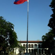
Kalayaan Hall
600 m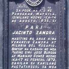
Father Jacinto Zamora historical marker
786 m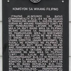
Commission on the Filipino Language historical marker
267 m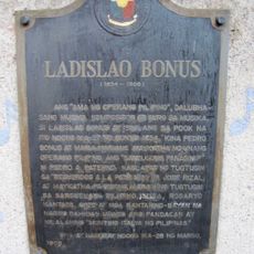
Ladislao Bonus historical marker
727 m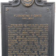
Florentino P. Cayco historical marker
442 m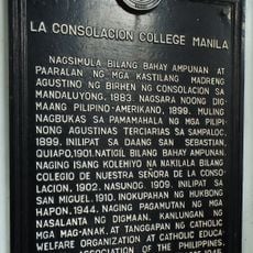
La Consolacion College Manila historical marker
635 m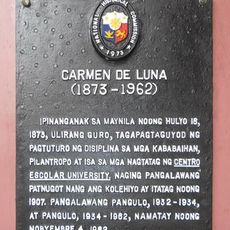
Carmen de Luna historical marker
770 m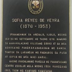
Sofia Reyes de Veyra historical marker
748 m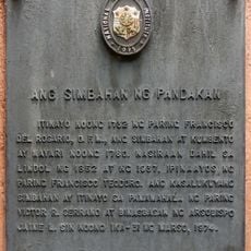
The Church of Pandacan historical marker
681 m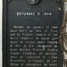
December 8, 1964 historical marker
822 m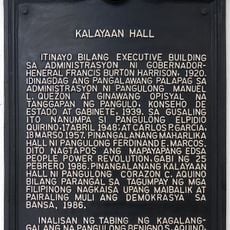
Kalayaan Hall historical marker
605 m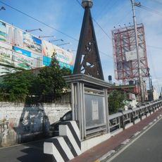
Mabini Bridge historical marker
478 m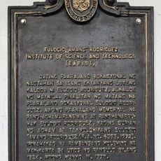
Eulogio “Amang” Rodriguez Institute of Science and Technology historical marker
222 m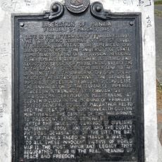
Liberation of Manila historical marker
700 m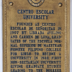
Centro Escolar University historical marker
812 m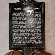
Malacañang Palace historical marker
678 m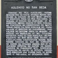
San Beda College historical marker
826 m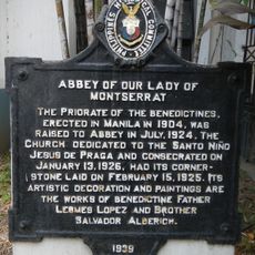
Abbey of Our Lady of Montserrat historical marker
732 m
Santa Catalina College historical marker
445 m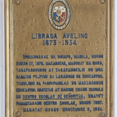
Librada Avelino historical marker
817 m
Alive!
374 m
Memorial
739 mReviews
Visited this place? Tap the stars to rate it and share your experience / photos with the community! Try now! You can cancel it anytime.
Discover hidden gems everywhere you go!
From secret cafés to breathtaking viewpoints, skip the crowded tourist spots and find places that match your style. Our app makes it easy with voice search, smart filtering, route optimization, and insider tips from travelers worldwide. Download now for the complete mobile experience.

A unique approach to discovering new places❞
— Le Figaro
All the places worth exploring❞
— France Info
A tailor-made excursion in just a few clicks❞
— 20 Minutes