Astrid Heitmann
Location: Enger
Creator: Astrid Heitmann
Creator: Astrid Heitmann
GPS coordinates: 52.11464,8.53591
Latest update: November 22, 2025 14:24
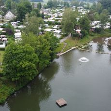
Elisabethsee
3 km
Evangelische Kirche Oldinghausen-Pödinghausen
1.1 km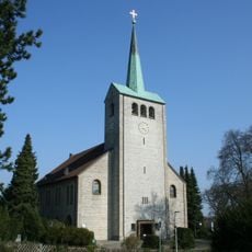
Marienkirche
2.1 km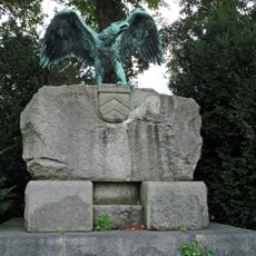
Grafschaftsdenkmal
2.3 km
Enger Bruch
2.5 km
Liebfrauenkirche
2.4 km
Gerberei-Museum Enger
2.9 km
Königsbrücke Jöllenbeck
2.3 km
Church of St Dionysius
2.6 km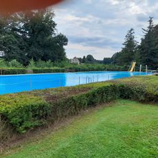
Freibad Lenzinghausen
2.8 km
LSG-Enger, Spenge
1.3 km
LSG-Tal-und Sieksysteme des Ravensberger Huegellandes und des Herforder Berglandes <"Fasanengrund">
2.6 km
Ravensberger Hügelland
3 km
Kleinbahnmuseum Enger
2.8 km
Elsterbuschdenkmal
2.6 km
Golfclub Ravensberger Land
1.4 km
Galerie im Gerbereimuseum
2.9 km
Enger zusammenrücken
2.9 km
Work of art, graffiti
3 km
Tower, Observation tower, scenic viewpoint
2.5 km
Oerken-Schule
2.4 km
Adlerdenkmal
2.3 km
Memorial, war memorial
1.9 km
Ruins
2 km
Ernst van Pels
2.7 km
Josef van Pels
2.7 km
Memorial, war memorial
2.3 km
Ehemalige königliche Mühle
2 kmReviews
Visited this place? Tap the stars to rate it and share your experience / photos with the community! Try now! You can cancel it anytime.
Discover hidden gems everywhere you go!
From secret cafés to breathtaking viewpoints, skip the crowded tourist spots and find places that match your style. Our app makes it easy with voice search, smart filtering, route optimization, and insider tips from travelers worldwide. Download now for the complete mobile experience.

A unique approach to discovering new places❞
— Le Figaro
All the places worth exploring❞
— France Info
A tailor-made excursion in just a few clicks❞
— 20 Minutes