Plant for the Future
Location: County Durham
Inception: January 1, 2017
Creator: Simon Clements
Creator: Simon Clements
GPS coordinates: 54.74172,-1.58733
Latest update: October 28, 2025 13:44
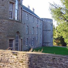
Croxdale Hall
1 km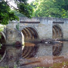
Sunderland Bridge
862 m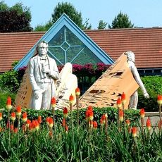
Durham University Botanic Garden
2.2 km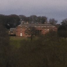
Burn Hall
585 m
Mount Oswald
2.1 km
Butterby Oxbow
982 m
Croxdale church
1 km
Church 50 metres north east of Croxdale Hall
1 km
Church of St Bartholomew
960 m
Croxdale Road Bridge
778 m
Croxdale Viaduct
1.1 km
Hollingside House And Wall
2.3 km
Low Butterby Farmhouse And Barn Adjoining At South-east
1.2 km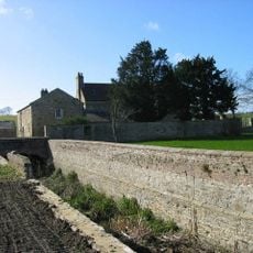
Moat Walls, 2 Bridges Across Moat, Garden Wall And Gate Piers At Low Butterby Farm
1.2 km
Fungate
2.2 km
Foxglove Post
2.2 km
Stone Circle
1.3 km
Stone Spiral
1.3 km
Stepping Stones
298 m
Willow Arbour
243 m
Willow Miner's Wife
467 m
Willow Miner
1.1 km
Vessels of Life
2.2 km
Miners Children
1.1 km
Work of art, sculpture
2.3 km
Work of art, sculpture
2.2 km
Work of art, sculpture
2.3 km
Scenic viewpoint
969 mReviews
Visited this place? Tap the stars to rate it and share your experience / photos with the community! Try now! You can cancel it anytime.
Discover hidden gems everywhere you go!
From secret cafés to breathtaking viewpoints, skip the crowded tourist spots and find places that match your style. Our app makes it easy with voice search, smart filtering, route optimization, and insider tips from travelers worldwide. Download now for the complete mobile experience.

A unique approach to discovering new places❞
— Le Figaro
All the places worth exploring❞
— France Info
A tailor-made excursion in just a few clicks❞
— 20 Minutes