Szent István
Location: Bátonyterenye
Creator: Koltai László
Creator: Koltai László
GPS coordinates: 47.99019,19.84149
Latest update: November 6, 2025 00:30
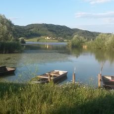
Maconka Reservoir
604 m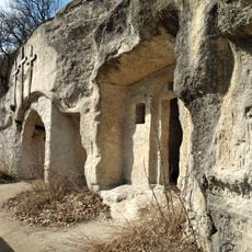
Hermit caves of Szentkút
6 km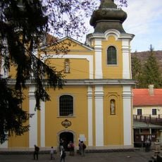
Basilica of Our Lady of Assumption, Mátraverebély-Szentkút
6.2 km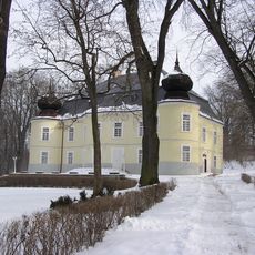
Gyürky-Solymossy Castle & Park, Kisterenye
2.2 km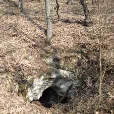
Betyár Cave
6.2 km
Tuzson Arboretum
6.6 km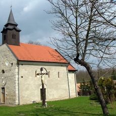
Roman Catholic Church in Maconka
144 m
Szeplőtelen fogantatás templom
6.9 km
Rákóczibánya
4.8 km
Scenic viewpoint
6.5 km
Címer
6.8 km
Kőbakancs
6.7 km
Bányagép
2.5 km
Vizslás
6.7 km
Szent-kút
6.1 km
Scenic viewpoint
6.3 km
Scenic viewpoint
6.5 km
Láncszemek
6.1 km
Scenic viewpoint
6.8 km
Scenic viewpoint
6.1 km
Scenic viewpoint
2.8 km
Scenic viewpoint
4 km
Scenic viewpoint
5 km
Scenic viewpoint
4.5 km
Scenic viewpoint
6.6 km
Scenic viewpoint
6.1 km
Scenic viewpoint
5.3 km
Scenic viewpoint
2.1 kmReviews
Visited this place? Tap the stars to rate it and share your experience / photos with the community! Try now! You can cancel it anytime.
Discover hidden gems everywhere you go!
From secret cafés to breathtaking viewpoints, skip the crowded tourist spots and find places that match your style. Our app makes it easy with voice search, smart filtering, route optimization, and insider tips from travelers worldwide. Download now for the complete mobile experience.

A unique approach to discovering new places❞
— Le Figaro
All the places worth exploring❞
— France Info
A tailor-made excursion in just a few clicks❞
— 20 Minutes