Cascade de Clars

Log in to your account

AroundUs is a community-driven map of interesting places, built by curious explorers like you. It grows with every review, story, and photo you share.
Connect to save your favorite spots, contribute locations, and create personalized routes.
By continuing, you accept our Terms and Conditions and our Privacy Policy

Cascade de Clars

Add to collection
Map
Suggest a change
Share

Cascade de Clars

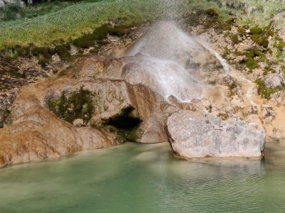
Cascade de Clars is a waterfall near Escragnolles in the French Alps, falling into a natural basin surrounded by forest and rocks. The water drops several meters and forms a small pool where cold mountain water collects.

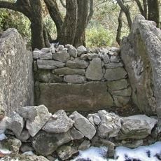
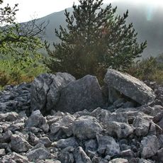
The waterfall was already known in ancient times, as shown by the remains of a Roman bridge on the path leading there. The route also passes dolmens dating from prehistoric times that document earlier human settlement.

The name Clars comes from the local language and refers to the clear water flowing over the rocks. Hikers often use the spot for a midday break at the base of the waterfall, sitting on large stones and watching the surroundings.

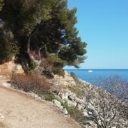
Access is via a yellow-marked hiking trail starting from the village and taking about two hours. At one point you must cross the small stream Le Ray, which can be slippery in spring or after rainfall.

The water remains extremely cold all year round, even in midsummer, as it comes directly from underground sources in the rock. Some caves nearby can be explored superficially and offer shaded spots on hot days.

Location: Escragnolles

Address: Unnamed Road, 06460 Escragnolles, France

GPS coordinates: 43.74103,6.75259

Latest update: December 5, 2025 11:04

Photos
Hiking along the French Riviera: Coastal paths between Nice and Monaco, from Cap d'Ail to the Gorges du Verdon

Between Nice and Monaco, coastal trails provide the opportunity to explore the Mediterranean coastline through various routes. The Cap d'Ail Coastal Path, Nietzsche's Path in Èze with 400 meters of elevation gain, and the Mont Boron Park in Nice with its 11 kilometers of marked trails allow exploration of the region from different perspectives. These routes alternate between seaside sections and uphill segments, offering views over the coast and inland areas. The geological diversity of the region is evident in the limestone cliffs lining the Route des Crêtes between La Ciotat and Cassis, the rock formations of Cap d'Ail, and the red rocks of the Esterel Massif. Further inland, the Verdon Gorges feature a canyon 700 meters deep, while the Mercantour National Park houses the Sentier des Géants within its ancient forest. The historical heritage marks these routes: the Nice Observatory on Mont Gros dates from the 19th century, Fort La Revere overlooks the coast from 696 meters altitude, and Saint-Honorat Island preserves its active monastery. These trails serve as direct accesses to the nature and history of the French Riviera.

Reviews

Visited this place? Tap the stars to rate it and share your experience / photos with the community! Try now! You can cancel it anytime.

« Cascade de Clars » is provided by Around Us (aroundus.com). Images and texts are derived from Wikimedia project under a Creative Commons license. You are allowed to copy, distribute, and modify copies of this page, under the conditions set by the license, as long as this note is clearly visible.

Discover hidden gems everywhere you go!

From secret cafés to breathtaking viewpoints, skip the crowded tourist spots and find places that match your style. Our app makes it easy with voice search, smart filtering, route optimization, and insider tips from travelers worldwide. Download now for the complete mobile experience.

Around Us App Screenshot

A unique approach to discovering new places

Le Figaro

All the places worth exploring

France Info

A tailor-made excursion in just a few clicks

20 Minutes