
Smith Rock State Park
18.4 km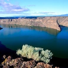
Lake Billy Chinook
16.6 km
Crooked River High Bridge
13.3 km
Peter Skene Ogden State Scenic Viewpoint
13.4 km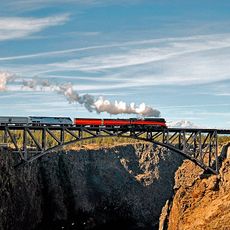
Crooked River Railroad Bridge
13.2 km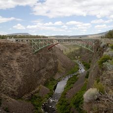
Crooked River Gorge
9.6 km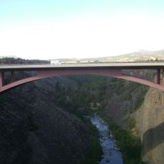
Rex T. Barber Veterans Memorial Bridge
13.3 km
Big Falls
8.9 km
Big Canyon Rim
13.9 km
Whychus Creek Rim
12.9 km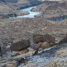
Metolius Balancing Rocks Overlook
16.4 km
Scenic viewpoint
16.4 km
Crooked River Ranch Golf Course
8.6 km
Scenic viewpoint
12.2 km
Scenic viewpoint
14 km
Scenic viewpoint
14.7 km
Scenic viewpoint
15.1 km
Scenic viewpoint
15.9 km
Scenic viewpoint
12.5 km
Peter Skene Ogden Scenic Viewpoint
13.3 km
Scenic viewpoint
13.6 km
Scenic viewpoint
16.9 km
Scenic viewpoint
18 km
Scenic viewpoint
18.1 km
Scenic viewpoint
18.3 km
Steelhead Falls
5.3 km
Scenic viewpoint
18.5 km
Dam Observatory
18.7 kmReviews
Visited this place? Tap the stars to rate it and share your experience / photos with the community! Try now! You can cancel it anytime.
Discover hidden gems everywhere you go!
From secret cafés to breathtaking viewpoints, skip the crowded tourist spots and find places that match your style. Our app makes it easy with voice search, smart filtering, route optimization, and insider tips from travelers worldwide. Download now for the complete mobile experience.

A unique approach to discovering new places❞
— Le Figaro
All the places worth exploring❞
— France Info
A tailor-made excursion in just a few clicks❞
— 20 Minutes