Smith Rock State Park, State park in central Oregon, United States.
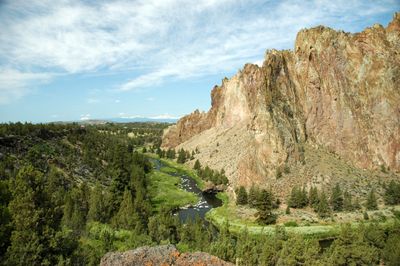
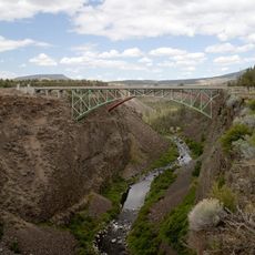
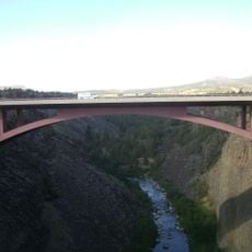
Smith Rock State Park is a protected area in Deschutes County, Oregon, with volcanic rock formations rising above the Crooked River. The tuff rock walls offer routes of varying difficulty, while the river flows through a canyon in the high desert of the region.
The site became a state park in 1960, after being used as grazing land before that. In the late 1980s, European climbers came and opened more difficult lines, bringing the area to international attention.
The park helped develop techniques that spread worldwide and shaped modern sport climbing. Hikers today follow trails along the river, from where they can watch climbers on the walls.
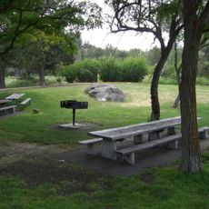
Trails lead from the parking area down to the river and then along the rock walls, with the descent potentially rocky. Summer brings high temperatures, making early mornings or late afternoons better for visiting.
An annual run of salmon moves up the river in autumn, traveling through shallow water where they are easily visible. This migration also draws raptors and other wildlife into the canyon, which can be observed from the banks.
Location: Deschutes County
Operator: Oregon Parks and Recreation Department
Address: NE Crooked River Drive
Website: http://oregonstateparks.org/park_51.php
GPS coordinates: 44.36930,-121.13800
Latest update: December 5, 2025 22:24
Lake Billy Chinook
30.4 km
The Cove Palisades State Park
28.3 km
Petersen Rock Garden
21 km
Tumalo State Park
31.1 km
Cline Falls State Scenic Viewpoint
14.6 km
Crooked River High Bridge
5.1 km
Peter Skene Ogden State Scenic Viewpoint
5.1 km
Crooked River Railroad Bridge
5.2 km
Crooked River Gorge
9.1 km
Sisters State Park
33.1 km
Rex T. Barber Veterans Memorial Bridge
5.1 km
Redmond–Bend Juniper State Scenic Corridor
22.2 km
Ochoco State Scenic Viewpoint
22.7 km
Milton Odem House
11.5 km
New Redmond Hotel
11.2 km
First Presbyterian Church of Redmond
10.9 km
Grizzly Mountain
16.4 km
Crook County Courthouse
24.6 km
A. R. Bowman Memorial Museum
24.3 km
Rock O' the Range Bridge
29.8 km
Thomas M. Baldwin House
24.3 km
Old First National Bank of Prineville
24.3 km
Crook County Bank Building
24.3 km
Marion Reed Elliott House
24.3 km
Lamonta Compound
23.6 km
Max and Ollie Lueddemann House
29.6 km
Pine Theater
24.3 km
Pilot Butte Canal Downtown Redmond Segment
9.3 kmReviews
Visited this place? Tap the stars to rate it and share your experience / photos with the community! Try now! You can cancel it anytime.
Discover hidden gems everywhere you go!
From secret cafés to breathtaking viewpoints, skip the crowded tourist spots and find places that match your style. Our app makes it easy with voice search, smart filtering, route optimization, and insider tips from travelers worldwide. Download now for the complete mobile experience.
A unique approach to discovering new places❞
— Le Figaro
All the places worth exploring❞
— France Info
A tailor-made excursion in just a few clicks❞
— 20 Minutes