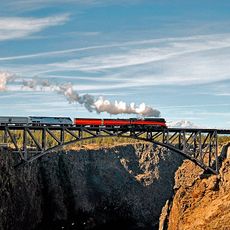
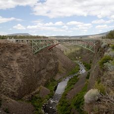
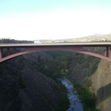
Crooked River High Bridge, Steel arch bridge in Terrebonne, Oregon
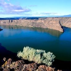
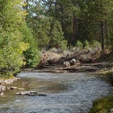
The Crooked River High Bridge is a steel arch structure that spans a deep gorge near Terrebonne. Its deck rises high above the canyon floor, creating a vantage point that reveals the full depth and width of the landscape below.
The original structure was completed in 1926 and served as a crucial transportation route connecting communities across the region. After serving vehicles for decades, it was converted to pedestrian use in the early 2000s.
The bridge serves as a striking focal point for visitors exploring the Crooked River Gorge and understanding how people move through this dramatic landscape. Many come to experience the scale of the canyon and capture the scale of the natural setting.
The bridge is easy to access and well-maintained for pedestrians of all abilities. Comfortable footwear is recommended, and be mindful of wind conditions that are common at this elevation.
The bridge has become a destination for commercial bungee jumping, attracting thrill-seekers who leap from its height. This use has transformed the crossing into a hub for adventure tourism in the region.
Location: Oregon
Inception: 1927
Official opening: 1926
GPS coordinates: 44.39200,-121.19400
Latest update: December 11, 2025 11:03
Smith Rock State Park
5.1 km
Lake Billy Chinook
25.8 km
The Cove Palisades State Park
24.5 km
Petersen Rock Garden
21.7 km
Tumalo State Park
31.5 km
Cline Falls State Scenic Viewpoint
14.6 km
Peter Skene Ogden State Scenic Viewpoint
75 m
Crooked River Railroad Bridge
188 m
Pelton Dam
33.8 km
Crooked River Gorge
4 km
Sisters State Park
29.7 km
Rex T. Barber Veterans Memorial Bridge
155 m
Redmond–Bend Juniper State Scenic Corridor
23.4 km
Ochoco State Scenic Viewpoint
27.8 km
Milton Odem House
13.5 km
First Presbyterian Church of Redmond
13.1 km
Grizzly Mountain
19.6 km
Crook County Courthouse
29.6 km
A. R. Bowman Memorial Museum
29.4 km
Rock O' the Range Bridge
30.8 km
Thomas M. Baldwin House
29.4 km
Old First National Bank of Prineville
29.3 km
Crook County Bank Building
29.4 km
Marion Reed Elliott House
29.3 km
Lamonta Compound
28.6 km
Max and Ollie Lueddemann House
27.6 km
Pine Theater
29.4 km
Pilot Butte Canal Downtown Redmond Segment
11.7 kmVisited this place? Tap the stars to rate it and share your experience / photos with the community! Try now! You can cancel it anytime.
Discover hidden gems everywhere you go!
From secret cafés to breathtaking viewpoints, skip the crowded tourist spots and find places that match your style. Our app makes it easy with voice search, smart filtering, route optimization, and insider tips from travelers worldwide. Download now for the complete mobile experience.
A unique approach to discovering new places❞
— Le Figaro
All the places worth exploring❞
— France Info
A tailor-made excursion in just a few clicks❞
— 20 Minutes