Enable Location

We need your location to show you interesting places around you

Discover nearby places

Find interesting locations and hidden gems around you

Precise directions

Get accurate directions and distances to places

Your location is never shared with other users. It's only used when you tap the location button.

Pelton Dam

Log in to your account

Start exploring — it's free

Trusted by 61,494 travelers worldwide

Continue with Google
Continue with Apple
or

We will send you a code to connect

By continuing, you accept our Terms and Conditions and our Privacy Policy

Check your inbox

We've sent a pincode in your inbox. Please enter the code below.

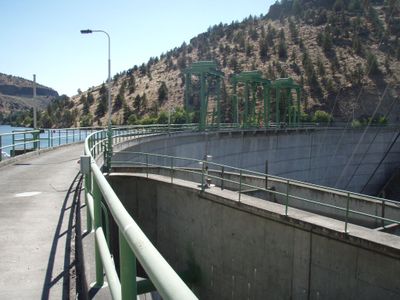
Pelton Dam, Hydroelectric power station in Jefferson County, United States.

Description

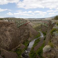
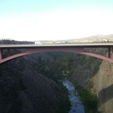
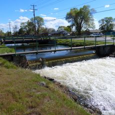
Pelton Dam is a concrete arch structure that crosses the Deschutes River and generates electricity for the region. The design harnesses water pressure and flow to drive turbines that produce renewable power for Oregon.

History

Construction finished in 1958 by Portland General Electric to harness water resources for power generation. It became part of a larger coordinated system of dams along the river designed to manage water and maximize energy output.

Culture

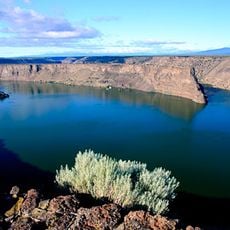
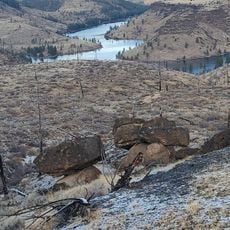
Lake Simtustus received its name from a Native American scout who served the U.S. Army during the 1867 campaign against the Paiutes.

Practical

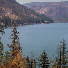
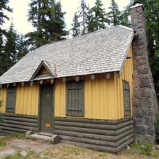
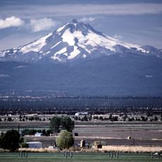
The location sits in a river valley surrounded by natural terrain, making the setting quite remote. Visitors should plan a drive to reach it and be prepared for changing weather conditions in the area.

Did you know?

On June 29, 2021, the location recorded 48.3°C, marking the third time Oregon reached its highest temperature record.

Location
Length
194 m
GPS coordinates
44.69420,-121.23100
Latest update
December 12, 2025 14:40

AroundUs brings together thousands of curated places, local tips, and hidden gems, enriched daily by 60,000 contributors worldwide. Discover all places nearby (Jefferson County).

Around this place
Smith Rock State Park
United States of America

Smith Rock State Park

36.9 km
Mount Jefferson
United States of America

Mount Jefferson

45.1 km
Lake Billy Chinook
United States of America

Lake Billy Chinook

15.8 km
The Cove Palisades State Park
United States of America

The Cove Palisades State Park

10.7 km
Mount Jefferson Wilderness
United States of America

Mount Jefferson Wilderness

45 km
Cline Falls State Scenic Viewpoint
United States of America

Cline Falls State Scenic Viewpoint

47.4 km
Crooked River High Bridge
United States of America

Crooked River High Bridge

33.8 km
Peter Skene Ogden State Scenic Viewpoint
United States of America

Peter Skene Ogden State Scenic Viewpoint

33.8 km
Olallie Butte
United States of America

Olallie Butte

44.5 km
Crooked River Railroad Bridge
United States of America

Crooked River Railroad Bridge

33.9 km
Crooked River Gorge
United States of America

Crooked River Gorge

30.9 km
Sisters State Park
United States of America

Sisters State Park

51.4 km
Rex T. Barber Veterans Memorial Bridge
United States of America

Rex T. Barber Veterans Memorial Bridge

33.6 km
Shaniko Hotel
United States of America

Shaniko Hotel

51.1 km
Milton Odem House
United States of America

Milton Odem House

47.3 km
The Museum at Warm Springs
United States of America

The Museum at Warm Springs

7.8 km
New Redmond Hotel
United States of America

New Redmond Hotel

47.2 km
First Presbyterian Church of Redmond
United States of America

First Presbyterian Church of Redmond

46.9 km
Grizzly Mountain
United States of America

Grizzly Mountain

35.9 km
Sisters High School
United States of America

Sisters High School

51.3 km
Camp Sherman Community Hall
United States of America

Camp Sherman Community Hall

43.5 km
Olallie Lake Guard Station
United States of America

Olallie Lake Guard Station

46.1 km
Jefferson Park Glacier
United States of America

Jefferson Park Glacier

45.5 km
Whitewater Glacier
United States of America

Whitewater Glacier

44.3 km
Max and Ollie Lueddemann House
United States of America

Max and Ollie Lueddemann House

10.7 km
Pilot Butte Canal Downtown Redmond Segment
United States of America

Pilot Butte Canal Downtown Redmond Segment

45.4 km
Shaniko Historic District
United States of America

Shaniko Historic District

51.2 km
Metolius Balancing Rocks Overlook
United States of America

Metolius Balancing Rocks Overlook

19.9 km
Show the full map
« Pelton Dam - Hydroelectric power station in Jefferson County, United States » is provided by Around Us (aroundus.com). Images and texts are derived from Wikimedia project under a Creative Commons license. You are allowed to copy, distribute, and modify copies of this page, under the conditions set by the license, as long as this note is clearly visible.

Discover hidden gems everywhere you go!

From secret cafés to breathtaking viewpoints, skip the crowded tourist spots and find places that match your style. Our app makes it easy with voice search, smart filtering, route optimization, and insider tips from travelers worldwide. Download now for the complete mobile experience.

Around Us App Screenshot

A unique approach to discovering new places

Le Figaro

All the places worth exploring

France Info

A tailor-made excursion in just a few clicks

20 Minutes

Around Us
Travel Guide & Maps
Download

Send to your phone

QR Code
1

Open the camera app on your mobile.

2

Point at the QR code with your camera. A notification will appear.

3

Tap the notification to open the link.