Enable Location

We need your location to show you interesting places around you

Discover nearby places

Find interesting locations and hidden gems around you

Precise directions

Get accurate directions and distances to places

Your location is never shared with other users. It's only used when you tap the location button.

Rudower Höhe

Log in to your account

Start exploring — it's free

Trusted by 62,279 travelers worldwide

Continue with Google
Continue with Apple
or

We will send you a code to connect

By continuing, you accept our Terms and Conditions and our Privacy Policy

Check your inbox

We've sent a pincode in your inbox. Please enter the code below.

Rudower Höhe

Rudower Höhe, Park in Neukölln district, Berlin, Germany.

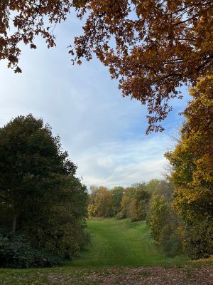
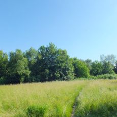
Rudower Höhe is a green space built around an artificial hill about 70 meters high, featuring walking trails, playgrounds and a viewing platform. The area invites visitors to stroll and enjoy outdoor activities.

The artificial hill was built in the 1950s from rubble left by wartime bombing and turned destruction into a place for rest and play. This transformation shows how Berlin recovered after World War II.

This place serves as a gathering spot where neighbors meet throughout the year for walks and outdoor play with children. Families regularly use the green spaces for relaxed afternoons and casual meetings.

The park is accessible year-round at no cost, located at Künnekeweg 1 with public transportation and nearby parking available. Visitors should wear comfortable shoes if planning to reach the viewing platform, as the climb to the top requires some effort.

In winter the hill becomes a popular sledding spot where families race down the snowy slopes. The site also preserves about 400 meters of the original Berlin Wall as a protected historical monument.

The community of curious travelers

AroundUs brings together thousands of curated places, local tips, and hidden gems, enriched daily by 60,000 contributors worldwide.

Start exploring
Location
Address
Künnekeweg 1, 12355 Berlin, Germany
GPS coordinates
52.41848,13.51909
Latest update
December 6, 2025 19:01
Berlin Wall history: remnants, memorials, walking routes, and sites to explore today

More than thirty years after its fall, the Berlin Wall still shapes the city. Between the districts of Mitte, Prenzlauer Berg, and Friedrichshain, fragments of concrete, watchtowers, and memorial plaques recall the division of a capital and its people. Some sections remain intact, others have been...

« Rudower Höhe - Park in Neukölln district, Berlin, Germany » is provided by Around Us (aroundus.com). Images and texts are derived from Wikimedia project under a Creative Commons license. You are allowed to copy, distribute, and modify copies of this page, under the conditions set by the license, as long as this note is clearly visible.

Discover hidden gems everywhere you go!

From secret cafés to breathtaking viewpoints, skip the crowded tourist spots and find places that match your style. Our app makes it easy with voice search, smart filtering, route optimization, and insider tips from travelers worldwide. Download now for the complete mobile experience.

Around Us App Screenshot

A unique approach to discovering new places

Le Figaro

All the places worth exploring

France Info

A tailor-made excursion in just a few clicks

20 Minutes

Around Us
Travel Guide & Maps
Download

Send to your phone

QR Code
1

Open the camera app on your mobile.

2

Point at the QR code with your camera. A notification will appear.

3

Tap the notification to open the link.