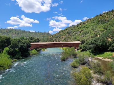
Historic Bridgeport Covered Bridge
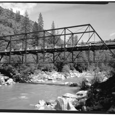
The Historic Bridgeport Covered Bridge is a wooden crossing over the South Yuba River near Penn Valley, spanning over 229 feet (70 meters) and built from local materials. The structure uses a mix of truss and arch construction styles, with wood sourced from a local mill and covered by a protective roof.
Built in 1862 during California's Gold Rush, the bridge served as part of the Virginia Turnpike toll road that connected miners and towns throughout the region. After nearly 150 years of service, it closed in 2011 for safety repairs and reopened in 2021 following restoration efforts by a community committee.
The bridge connects two communities that grew during the Gold Rush era and still carries that historical identity in its name. It draws photographers and visitors who come to appreciate the craftsmanship and simple engineering of an earlier time.
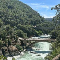
The site is located in South Yuba River State Park with well-maintained paths nearby that provide easy access to the river and surrounding areas. Plan time for a leisurely walk across and around the structure, and note that basic facilities like picnic areas are available in the vicinity.
The site has become popular with photographers and social media users, as the aged wooden structure framed by trees and the flowing river creates a striking visual composition. Visitors can also try gold panning in summer months and join wildflower hikes in spring, activities that connect directly to the region's Gold Rush heritage.
The community of curious travelers
AroundUs brings together thousands of curated places, local tips, and hidden gems, enriched daily by 60,000 contributors worldwide.