Enable Location

We need your location to show you interesting places around you

Discover nearby places

Find interesting locations and hidden gems around you

Precise directions

Get accurate directions and distances to places

Your location is never shared with other users. It's only used when you tap the location button.

Englebright Lake

Log in to your account

Start exploring — it's free

Trusted by 62,376 travelers worldwide

Continue with Google
Continue with Apple
or

We will send you a code to connect

By continuing, you accept our Terms and Conditions and our Privacy Policy

Check your inbox

We've sent a pincode in your inbox. Please enter the code below.

Englebright Lake

Englebright Lake, body of water

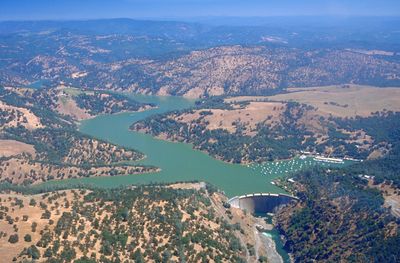
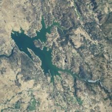
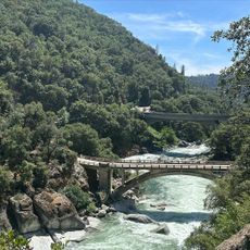
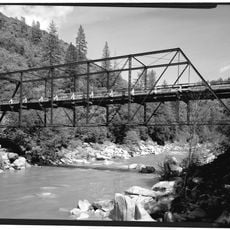
Englebright Lake is a reservoir in the Sierra Nevada mountains created by a dam across the Yuba River Canyon. The water stretches nearly nine miles and is accessible mostly by boat, kayak, or paddleboard, with over 20 miles of shoreline and many narrow canyon passages.

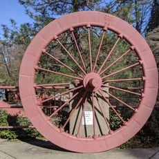
The lake was created in the 1940s when a dam was built to hold back debris from historic mining in the region and control flooding. The construction later enabled two hydroelectric plants below the dam to generate power for about 50,000 homes.

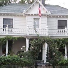
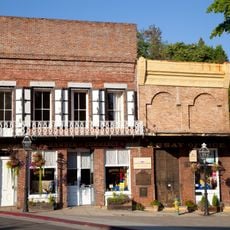
The lake's name comes from early settlers of the region. The way people spend time here reflects how the community values quiet, nature-based activities, especially fishing and living on the water with houseboats.

The lake is reached by car via Route 20 and Mooney Flat Road from Grass Valley or Nevada City. Access to campsites is only by boat, so you need to bring your own or rent one at Skippers Cove. Drinking water and restrooms are available at boat launch areas.

The upper four miles of the lake are mostly free from water skiing and towing activities, allowing for especially quiet exploration through narrow canyon bends and hidden coves. This remote area appeals to paddlers seeking solitude and unforgettable views.

The community of curious travelers

AroundUs brings together thousands of curated places, local tips, and hidden gems, enriched daily by 60,000 contributors worldwide.

Start exploring
Location
GPS coordinates
39.24028,-121.27028
Latest update
February 7, 2026 11:00
Around this place
Empire Mine State Historic Park
United States of America

Empire Mine State Historic Park

20 km
New Bullards Bar Reservoir
United States of America

New Bullards Bar Reservoir

20.4 km
New Bullards Bar Dam
United States of America

New Bullards Bar Dam

20.3 km
South Yuba River State Park
United States of America

South Yuba River State Park

8.7 km
Bridgeport Covered Bridge
United States of America

Bridgeport Covered Bridge

8.7 km
Home of Lola Montez
United States of America

Home of Lola Montez

18 km
Camp Far West Reservoir
United States of America

Camp Far West Reservoir

21.3 km
North Star House
United States of America

North Star House

17.5 km
National Exchange Hotel
United States of America

National Exchange Hotel

22 km
Nevada City Downtown Historic District
United States of America

Nevada City Downtown Historic District

21.8 km
Englebright Dam
United States of America

Englebright Dam

114 m
Mount Saint Mary's Convent and Academy
United States of America

Mount Saint Mary's Convent and Academy

17.8 km
Nevada Brewery
United States of America

Nevada Brewery

22.2 km
Nevada Theatre
United States of America

Nevada Theatre

21.7 km
Grass Valley Public Library
United States of America

Grass Valley Public Library

18 km
Maria's
United States of America

Maria's

18.4 km
Oregon Creek Covered Bridge
United States of America

Oregon Creek Covered Bridge

23.8 km
Doris Foley Library for Historical Research
United States of America

Doris Foley Library for Historical Research

21.8 km
Collins Lake Beach
United States of America

Collins Lake Beach

11.4 km
Martin Luther Marsh House
United States of America

Martin Luther Marsh House

22.7 km
Trinity Church (Nevada City)
United States of America

Trinity Church (Nevada City)

22.1 km
Aaron A. Sargent House
United States of America

Aaron A. Sargent House

21.7 km
Ott's Assay Office
United States of America

Ott's Assay Office

22.1 km
Prosperity Lanes
United States of America

Prosperity Lanes

18.5 km
Hoyt Crossing Nude Beach
United States of America

Hoyt Crossing Nude Beach

17.8 km
Northstar Mining Museum
United States of America

Northstar Mining Museum

17.7 km
Purdon Crossing Bridge
United States of America

Purdon Crossing Bridge

21.6 km
Grass Valley Library-Royce Branch
United States of America

Grass Valley Library-Royce Branch

18 km
Show the full map
« Englebright Lake - body of water » is provided by Around Us (aroundus.com). Images and texts are derived from Wikimedia project under a Creative Commons license. You are allowed to copy, distribute, and modify copies of this page, under the conditions set by the license, as long as this note is clearly visible.

Discover hidden gems everywhere you go!

From secret cafés to breathtaking viewpoints, skip the crowded tourist spots and find places that match your style. Our app makes it easy with voice search, smart filtering, route optimization, and insider tips from travelers worldwide. Download now for the complete mobile experience.

Around Us App Screenshot

A unique approach to discovering new places

Le Figaro

All the places worth exploring

France Info

A tailor-made excursion in just a few clicks

20 Minutes

Around Us
Travel Guide & Maps
Download

Send to your phone

QR Code
1

Open the camera app on your mobile.

2

Point at the QR code with your camera. A notification will appear.

3

Tap the notification to open the link.