Enable Location

We need your location to show you interesting places around you

Discover nearby places

Find interesting locations and hidden gems around you

Precise directions

Get accurate directions and distances to places

Your location is never shared with other users. It's only used when you tap the location button.

Camp Far West Reservoir

Log in to your account

Start exploring — it's free

Trusted by 62,377 travelers worldwide

Continue with Google
Continue with Apple
or

We will send you a code to connect

By continuing, you accept our Terms and Conditions and our Privacy Policy

Check your inbox

We've sent a pincode in your inbox. Please enter the code below.

Camp Far West Reservoir

Camp Far West Reservoir, body of water

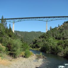
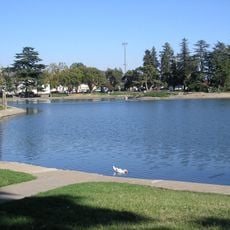
Camp Far West Reservoir is a large body of water in the foothills of Northern California, located about eight miles east of Wheatland. It covers about 2,000 acres with nearly 30 miles of shoreline, fed by the Bear River and Rock Creek, and is surrounded by rolling hills and oak trees.

The reservoir was built in 1963 to control floods in the Central Valley and generate electricity for nearby areas. The dam became part of the California State Water Project, a large effort to manage water across the state.

The reservoir's name comes from a historic camp that once stood in this area. Today, visitors experience the place as a quiet retreat where trails invite walking and the open landscape shapes how people spend time outdoors.

Visitor facilities are located on the north side, including wheelchair-accessible restrooms and vault toilets. Trails and cycling routes wind around the lake year-round and are easy to access, with campsites featuring picnic tables and grills spread along the shoreline.

Cattle roam freely across the grounds and graze on the trails, giving the place a countryside feel. Visitors should know that fish in the reservoir contain elevated mercury levels, so eating any catch is not recommended.

The community of curious travelers

AroundUs brings together thousands of curated places, local tips, and hidden gems, enriched daily by 60,000 contributors worldwide.

Start exploring
Location
GPS coordinates
39.05175,-121.31447
Latest update
February 7, 2026 11:00
Around this place
Foresthill Bridge
United States of America

Foresthill Bridge

27.8 km
Bok Kai Temple
United States of America

Bok Kai Temple

25.3 km
Englebright Lake
United States of America

Englebright Lake

21.3 km
Home of Lola Montez
United States of America

Home of Lola Montez

28.4 km
Ellis Lake
United States of America

Ellis Lake

25.9 km
North Star House
United States of America

North Star House

26 km
Griffith Quarry
United States of America

Griffith Quarry

25.8 km
Englebright Dam
United States of America

Englebright Dam

21.3 km
Mount Saint Mary's Convent and Academy
United States of America

Mount Saint Mary's Convent and Academy

28 km
Grass Valley Public Library
United States of America

Grass Valley Public Library

28.3 km
Mountain Quarries Bridge
United States of America

Mountain Quarries Bridge

28.3 km
Bernhard Museum Complex
United States of America

Bernhard Museum Complex

27.3 km
Yuba City Astronomical Observatory
United States of America

Yuba City Astronomical Observatory

28.5 km
Auburn Public Library
United States of America

Auburn Public Library

27 km
Hart Building
United States of America

Hart Building

25.6 km
Auburn Masonic Temple
United States of America

Auburn Masonic Temple

27.1 km
Packard Library
United States of America

Packard Library

25.5 km
Oddfellows Hall
United States of America

Oddfellows Hall

26.9 km
Wheatland Masonic Temple
United States of America

Wheatland Masonic Temple

10.4 km
Marysville Historic Commercial District
United States of America

Marysville Historic Commercial District

25.6 km
Northstar Mining Museum
United States of America

Northstar Mining Museum

27.4 km
The Gold Rush Museum
United States of America

The Gold Rush Museum

27.2 km
Griffith Quarry Park & Museum
United States of America

Griffith Quarry Park & Museum

26.1 km
Grass Valley Library-Royce Branch
United States of America

Grass Valley Library-Royce Branch

28.4 km
Placer County Courthouse
United States of America

Placer County Courthouse

26.9 km
Giant Indian Statues
United States of America

Giant Indian Statues

26.3 km
Yuba County Library
United States of America

Yuba County Library

25.5 km
Gauche Aquatic Park
United States of America

Gauche Aquatic Park

27.1 km
Show the full map
« Camp Far West Reservoir - body of water » is provided by Around Us (aroundus.com). Images and texts are derived from Wikimedia project under a Creative Commons license. You are allowed to copy, distribute, and modify copies of this page, under the conditions set by the license, as long as this note is clearly visible.

Discover hidden gems everywhere you go!

From secret cafés to breathtaking viewpoints, skip the crowded tourist spots and find places that match your style. Our app makes it easy with voice search, smart filtering, route optimization, and insider tips from travelers worldwide. Download now for the complete mobile experience.

Around Us App Screenshot

A unique approach to discovering new places

Le Figaro

All the places worth exploring

France Info

A tailor-made excursion in just a few clicks

20 Minutes

Around Us
Travel Guide & Maps
Download

Send to your phone

QR Code
1

Open the camera app on your mobile.

2

Point at the QR code with your camera. A notification will appear.

3

Tap the notification to open the link.