Empire Mine State Historic Park

Log in to your account

AroundUs is a community-driven map of interesting places, built by curious explorers like you. It grows with every review, story, and photo you share.
Connect to save your favorite spots, contribute locations, and create personalized routes.
Continue with Google
Continue with Apple
Continue with X
Continue with Facebook
Continue with email
By continuing, you accept our Terms and Conditions and our Privacy Policy
Create an account
Add to collection
Map
Suggest a change
Share

Empire Mine State Historic Park, Gold mining historical complex in Grass Valley, US.

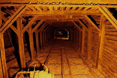
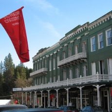
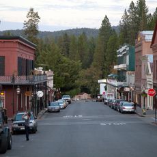
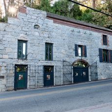
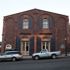
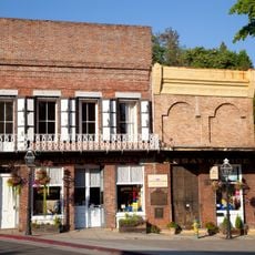
Empire Mine State Historic Park is a preserved mining complex in Grass Valley, California, with original buildings, equipment yards, and access to portions of the underground tunnel system. The site covers several hundred acres and includes administrative buildings, shafts, a blacksmith shop, a machine workshop, and the former owners' residence.

The mine began operation in the mid-1800s during the California gold rush and ran continuously for over a century until closing in the mid-1950s. The owners brought experienced miners from Cornwall who dug deeper shafts and introduced more advanced extraction systems.

The site takes its name from the company that operated it using methods imported from Cornwall. The contrast between simple worker buildings and the owners' residence with its formal gardens shows how wealth flowed upward during the mining era.

Tours of the mining yard and buildings operate during warmer months, with pathways between stations mostly level and easy to walk. The park opens year-round for outdoor self-guided walks supported by interpretive signs.

A small room in the visitor center houses a hand-built model of the underground tunnels that took decades to complete. The model is based on survey data and shows how the shafts extend beneath the town itself.

Location: Grass Valley

Inception: 1975

Phone: +15302738522

Website: https://parks.ca.gov/?page_id=499

GPS coordinates: 39.20360,-121.04300

Latest update: December 20, 2025 16:00

Photos
Around this place
New Bullards Bar Reservoir
United States of America

New Bullards Bar Reservoir

22.7 km
New Bullards Bar Dam
United States of America

New Bullards Bar Dam

22.8 km
South Yuba River State Park
United States of America

South Yuba River State Park

16.4 km
Bridgeport Covered Bridge
United States of America

Bridgeport Covered Bridge

16.4 km
Scotts Flat Reservoir
United States of America

Scotts Flat Reservoir

12.4 km
Sugar Pine Reservoir
United States of America

Sugar Pine Reservoir

23 km
Englebright Lake
United States of America

Englebright Lake

20 km
Home of Lola Montez
United States of America

Home of Lola Montez

2.3 km
Camp Far West Reservoir
United States of America

Camp Far West Reservoir

28.9 km
North Star House
United States of America

North Star House

3.1 km
National Exchange Hotel
United States of America

National Exchange Hotel

6.9 km
Nevada City Downtown Historic District
United States of America

Nevada City Downtown Historic District

7 km
Englebright Dam
United States of America

Englebright Dam

19.9 km
Mount Saint Mary's Convent and Academy
United States of America

Mount Saint Mary's Convent and Academy

2.4 km
Nevada Brewery
United States of America

Nevada Brewery

6.9 km
Nevada Theatre
United States of America

Nevada Theatre

6.9 km
Grass Valley Public Library
United States of America

Grass Valley Public Library

2.3 km
Oregon Creek Covered Bridge
United States of America

Oregon Creek Covered Bridge

21.8 km
Doris Foley Library for Historical Research
United States of America

Doris Foley Library for Historical Research

7 km
Collins Lake Beach
United States of America

Collins Lake Beach

28.1 km
Martin Luther Marsh House
United States of America

Martin Luther Marsh House

7.7 km
Trinity Church (Nevada City)
United States of America

Trinity Church (Nevada City)

7.1 km
Aaron A. Sargent House
United States of America

Aaron A. Sargent House

7 km
Ott's Assay Office
United States of America

Ott's Assay Office

7 km
Hoyt Crossing Nude Beach
United States of America

Hoyt Crossing Nude Beach

11.5 km
Northstar Mining Museum
United States of America

Northstar Mining Museum

2.4 km
Purdon Crossing Bridge
United States of America

Purdon Crossing Bridge

13.8 km
Grass Valley Library-Royce Branch
United States of America

Grass Valley Library-Royce Branch

2.3 km
Show the full map
Reviews

Visited this place? Tap the stars to rate it and share your experience / photos with the community! Try now! You can cancel it anytime.

« Empire Mine State Historic Park - Gold mining historical complex in Grass Valley, US » is provided by Around Us (aroundus.com). Images and texts are derived from Wikimedia project under a Creative Commons license. You are allowed to copy, distribute, and modify copies of this page, under the conditions set by the license, as long as this note is clearly visible.

Discover hidden gems everywhere you go!

From secret cafés to breathtaking viewpoints, skip the crowded tourist spots and find places that match your style. Our app makes it easy with voice search, smart filtering, route optimization, and insider tips from travelers worldwide. Download now for the complete mobile experience.

Around Us App Screenshot

A unique approach to discovering new places

Le Figaro

All the places worth exploring

France Info

A tailor-made excursion in just a few clicks

20 Minutes