Grass Valley

Log in to your account

AroundUs is a community-driven map of interesting places, built by curious explorers like you. It grows with every review, story, and photo you share.
Connect to save your favorite spots, contribute locations, and create personalized routes.
Continue with Google
Continue with Apple
Continue with X
Continue with Facebook
Continue with email
By continuing, you accept our Terms and Conditions and our Privacy Policy
Create an account
Add to collection
Map
Suggest a change
Share

Grass Valley, Mining town in Nevada County, California

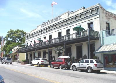
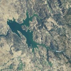
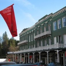
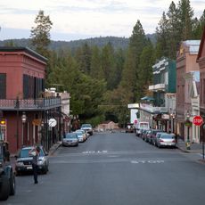
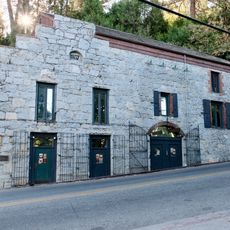
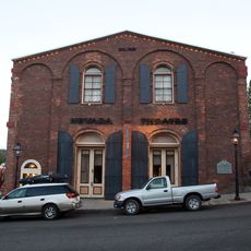
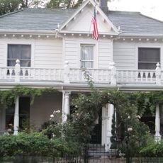
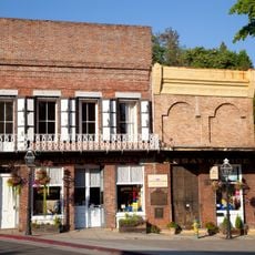
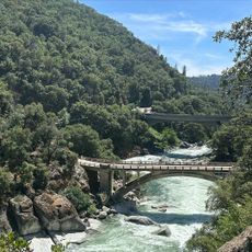
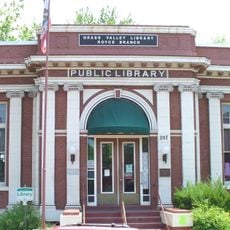
Grass Valley sits in the Sierra Nevada foothills at an elevation of 2,400 feet (735 meters) and covers 4.7 square miles with granitic rock formations. The town preserves gold rush era buildings along its main streets, where period storefronts and mining structures shape the appearance.

The discovery of gold at Gold Hill in 1850 transformed Boston Ravine into Grass Valley, which became incorporated as a city in 1860. The mines attracted Cornish miners who brought their expertise in hard-rock mining and shaped the development until World War II.

The influence of Cornish tin miners remains evident through annual celebrations, traditional pasties, and connections with sister city Bodmin in Cornwall. This tradition stays visible in the townscape and local customs that visitors can experience today.

The Gold Country Stage provides public transportation throughout the urban areas, connecting with major routes including State Route 49 and State Route 20. The town is about an hour's drive from Sacramento and offers parking in the downtown historic district.

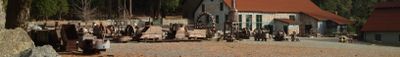
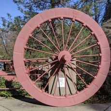
The Empire Mine and North Star Mine ranked among California's most productive gold operations until their closure during World War II. Today visitors can tour the Empire Mine as a State Historic Park and see the underground passages and surface facilities.

Location: Nevada County

Elevation above the sea: 735 m

Shares border with: Nevada City

Website: http://cityofgrassvalley.com

GPS coordinates: 39.21917,-121.05833

Latest update: December 12, 2025 22:07

Photos
Around this place
Empire Mine State Historic Park
United States of America

Empire Mine State Historic Park

2.2 km
New Bullards Bar Reservoir
United States of America

New Bullards Bar Reservoir

20.6 km
New Bullards Bar Dam
United States of America

New Bullards Bar Dam

20.7 km
South Yuba River State Park
United States of America

South Yuba River State Park

14.3 km
Bridgeport Covered Bridge
United States of America

Bridgeport Covered Bridge

14.3 km
Scotts Flat Reservoir
United States of America

Scotts Flat Reservoir

12.5 km
Sugar Pine Reservoir
United States of America

Sugar Pine Reservoir

24.9 km
Englebright Lake
United States of America

Englebright Lake

18.4 km
Home of Lola Montez
United States of America

Home of Lola Montez

569 m
Camp Far West Reservoir
United States of America

Camp Far West Reservoir

28.9 km
North Star House
United States of America

North Star House

3.2 km
National Exchange Hotel
United States of America

National Exchange Hotel

6 km
Nevada City Downtown Historic District
United States of America

Nevada City Downtown Historic District

6 km
Englebright Dam
United States of America

Englebright Dam

18.3 km
Mount Saint Mary's Convent and Academy
United States of America

Mount Saint Mary's Convent and Academy

898 m
Nevada Brewery
United States of America

Nevada Brewery

6 km
Nevada Theatre
United States of America

Nevada Theatre

5.9 km
Grass Valley Public Library
United States of America

Grass Valley Public Library

588 m
Oregon Creek Covered Bridge
United States of America

Oregon Creek Covered Bridge

19.9 km
Doris Foley Library for Historical Research
United States of America

Doris Foley Library for Historical Research

6 km
Collins Lake Beach
United States of America

Collins Lake Beach

26.1 km
Martin Luther Marsh House
United States of America

Martin Luther Marsh House

6.9 km
Trinity Church (Nevada City)
United States of America

Trinity Church (Nevada City)

6.1 km
Aaron A. Sargent House
United States of America

Aaron A. Sargent House

5.9 km
Ott's Assay Office
United States of America

Ott's Assay Office

6.1 km
Hoyt Crossing Nude Beach
United States of America

Hoyt Crossing Nude Beach

9.5 km
Northstar Mining Museum
United States of America

Northstar Mining Museum

1.6 km
Grass Valley Library-Royce Branch
United States of America

Grass Valley Library-Royce Branch

498 m
Show the full map
Reviews

Visited this place? Tap the stars to rate it and share your experience / photos with the community! Try now! You can cancel it anytime.

« Grass Valley - Mining town in Nevada County, California » is provided by Around Us (aroundus.com). Images and texts are derived from Wikimedia project under a Creative Commons license. You are allowed to copy, distribute, and modify copies of this page, under the conditions set by the license, as long as this note is clearly visible.

Discover hidden gems everywhere you go!

From secret cafés to breathtaking viewpoints, skip the crowded tourist spots and find places that match your style. Our app makes it easy with voice search, smart filtering, route optimization, and insider tips from travelers worldwide. Download now for the complete mobile experience.

Around Us App Screenshot

A unique approach to discovering new places

Le Figaro

All the places worth exploring

France Info

A tailor-made excursion in just a few clicks

20 Minutes