Enable Location

We need your location to show you interesting places around you

Discover nearby places

Find interesting locations and hidden gems around you

Precise directions

Get accurate directions and distances to places

Your location is never shared with other users. It's only used when you tap the location button.

Lago di Sauris

Log in to your account

Start exploring — it's free

Trusted by 62,173 travelers worldwide

Continue with Google
Continue with Apple
or

We will send you a code to connect

By continuing, you accept our Terms and Conditions and our Privacy Policy

Check your inbox

We've sent a pincode in your inbox. Please enter the code below.

Lago di Sauris

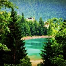
Lago di Sauris, lake in Friuli–Venezia Giulia, Italy

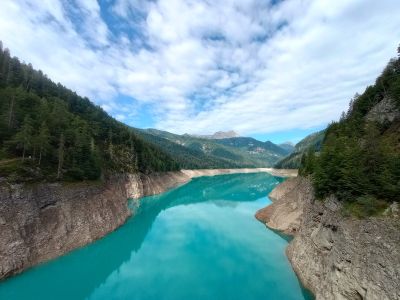
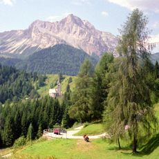
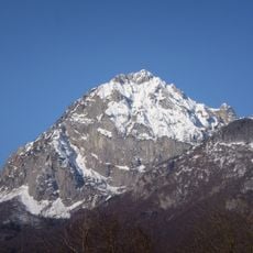
Lago di Sauris is an artificial lake in the mountains of Friuli Venezia Giulia, created in 1948 when a dam was built on the Lumiei river. The lake sits at about 3,300 feet (1,000 meters) elevation and is ringed by forested slopes with mountain peaks rising beyond.

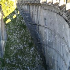
The lake was created in 1948 when engineer Carlo Semenza designed the dam on the Lumiei river, the same engineer who later designed the famous Vajont dam nearby. The dam was among Italy's tallest structures when completed and serves as a water reservoir for hydroelectric power.

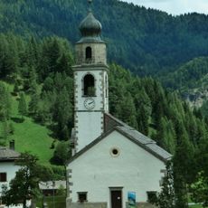
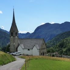
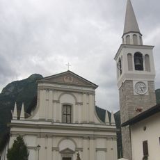
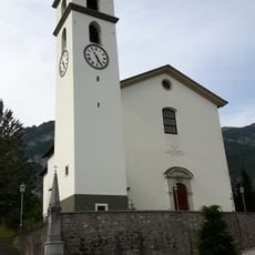
The name Sauris reflects a local dialect with German roots that residents still speak today. Visitors can see traditional crafts in action, from ham production to local cheeses sold in small village shops, keeping centuries-old food-making methods alive.

The lake is open year-round with no entrance fee, though most visitors come during warmer months when walking paths around the shore are most accessible. Multiple roads lead to the shoreline, making arrival by car straightforward, though mountain roads can be steep and winding.

During maintenance work, the lake is periodically drained, revealing submerged ruins including remains of an old hotel that once served travelers. These occasional discoveries offer glimpses into the life that existed in this valley before the lake was created.

The community of curious travelers

AroundUs brings together thousands of curated places, local tips, and hidden gems, enriched daily by 60,000 contributors worldwide.

Start exploring
Elevation above the sea
977 m
Address
Lago di Sàuris, Ente di decentramento regionale di Udine, Italy
GPS coordinates
46.44834,12.72251
Latest update
January 13, 2026 14:44
Friuli Venezia Giulia: Adriatic coasts, mountain villages and history

Friuli Venezia Giulia is found between the Adriatic Sea and the mountain peaks. This part of northeastern Italy has port cities with history from Austria-Hungary, Roman sites listed as world heritage, castles on the edge of the sea, and villages tucked in the mountains. Trieste, with its squares...

« Lago di Sauris - lake in Friuli–Venezia Giulia, Italy » is provided by Around Us (aroundus.com). Images and texts are derived from Wikimedia project under a Creative Commons license. You are allowed to copy, distribute, and modify copies of this page, under the conditions set by the license, as long as this note is clearly visible.

Discover hidden gems everywhere you go!

From secret cafés to breathtaking viewpoints, skip the crowded tourist spots and find places that match your style. Our app makes it easy with voice search, smart filtering, route optimization, and insider tips from travelers worldwide. Download now for the complete mobile experience.

Around Us App Screenshot

A unique approach to discovering new places

Le Figaro

All the places worth exploring

France Info

A tailor-made excursion in just a few clicks

20 Minutes

Around Us
Travel Guide & Maps
Download

Send to your phone

QR Code
1

Open the camera app on your mobile.

2

Point at the QR code with your camera. A notification will appear.

3

Tap the notification to open the link.