Enable Location

We need your location to show you interesting places around you

Discover nearby places

Find interesting locations and hidden gems around you

Precise directions

Get accurate directions and distances to places

Your location is never shared with other users. It's only used when you tap the location button.

Vale Glaciar do Zêzere

Log in to your account

Start exploring — it's free

Trusted by 62,475 travelers worldwide

Continue with Google
Continue with Apple
or

We will send you a code to connect

By continuing, you accept our Terms and Conditions and our Privacy Policy

Check your inbox

We've sent a pincode in your inbox. Please enter the code below.

Vale Glaciar do Zêzere

Vale Glaciar do Zêzere

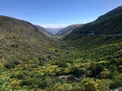
Vale Glaciar do Zêzere is a valley with steep U-shaped sides carved by ancient glaciers, stretching about 13 kilometers from the source of the Zêzere River to the town of Manteigas. Throughout the valley, you can spot glacial features like moraines and scattered boulders, with the river flowing through green meadows where livestock graze.

This valley was carved by a massive glacier during the last ice age more than 10,000 years ago, which left behind deposits and rock formations as it melted. The main glacier extended all the way to where Manteigas stands today, reshaping the entire landscape through its slow movement.

The valley represents how people have adapted to mountain life over centuries, visible in the old stone houses and sheep grazing on its slopes. These structures and practices remain connected to the land's rhythms and resources.

The valley has walking paths that allow you to explore at your own pace, with easier sections in the lower meadows and more challenging terrain as you climb the slopes. Wear sturdy footwear and bring adequate water, as the terrain is rocky and exposed to mountain weather conditions.

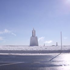
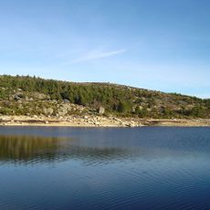
The Poio do Judeu is an enormous granite boulder transported by ancient glaciers, sitting alone in the valley like a stone sentinel from the ice age. Nearby, the small mountain lake Covão D'Ametade sits at about 4,660 feet (1,420 meters) near Magro peak and was born from glacial melt, offering clear waters surrounded by rocky shores.

The community of curious travelers

AroundUs brings together thousands of curated places, local tips, and hidden gems, enriched daily by 60,000 contributors worldwide.

Start exploring
Address
6260 Manteigas, Portugal
GPS coordinates
40.35716,-7.56023
Latest update
January 20, 2026 16:20
Center of Portugal: historic sites, villages and nature between mountain and ocean

The Center of Portugal brings together university towns, villages of stone built into the mountains, sandy beaches, and forests reaching up to the peaks of Serra da Estrela. Between the Atlantic coast and the inland, this area shows old cathedrals, monasteries listed by UNESCO, canals lined with...

« Vale Glaciar do Zêzere » is provided by Around Us (aroundus.com). Images and texts are derived from Wikimedia project under a Creative Commons license. You are allowed to copy, distribute, and modify copies of this page, under the conditions set by the license, as long as this note is clearly visible.

Discover hidden gems everywhere you go!

From secret cafés to breathtaking viewpoints, skip the crowded tourist spots and find places that match your style. Our app makes it easy with voice search, smart filtering, route optimization, and insider tips from travelers worldwide. Download now for the complete mobile experience.

Around Us App Screenshot

A unique approach to discovering new places

Le Figaro

All the places worth exploring

France Info

A tailor-made excursion in just a few clicks

20 Minutes

Around Us
Travel Guide & Maps
Download

Send to your phone

QR Code
1

Open the camera app on your mobile.

2

Point at the QR code with your camera. A notification will appear.

3

Tap the notification to open the link.