Enable Location

We need your location to show you interesting places around you

Discover nearby places

Find interesting locations and hidden gems around you

Precise directions

Get accurate directions and distances to places

Your location is never shared with other users. It's only used when you tap the location button.

Barunguba Montague Island

Log in to your account

Join the adventure

Create your free account and start exploring (like 60k+ others)

We will send you a code to connect

or
Continue with Google
Continue with Apple
By continuing, you accept our Terms and Conditions and our Privacy Policy

Check your inbox

We've sent a pincode in your inbox. Please enter the code below.

Barunguba Montague Island

Barunguba Montague Island

Description

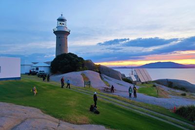
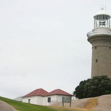
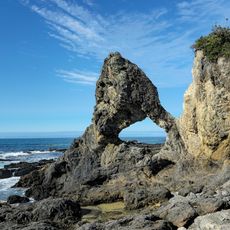
Barunguba Montague Island is a small rocky landmass off the southern New South Wales coast, surrounded by clear waters and natural features. The island contains a historic lighthouse, over ninety bird species, seal colonies that rest on the rocks, and a network of walking trails connecting viewpoints and accommodations.

History

The Yuin people held this place sacred long before European contact shaped its use. A lighthouse was constructed over 150 years ago to guide ships safely along the coast and has remained a defining feature ever since.

Culture

The island holds deep meaning for the Yuin people, whose stories and connection to this place remain visible throughout. Visitors experience this cultural layer when learning about local traditions during guided tours and encounters with historic structures linked to these communities.

Practical

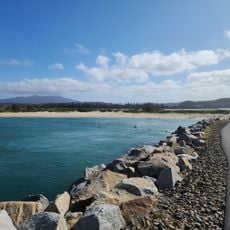
Access is only by boat from the nearby town of Narooma, a journey of about 20 minutes, and visitors must book through local tour operators in advance. Bring comfortable walking shoes, warm clothing, and snacks, as facilities on the island are basic and weather can change quickly.

Did you know?

The island once served as a prison station and later housed a naval orphanage, a history largely overshadowed by the seals and birds visible today. Few visitors realize that beneath this thriving marine landscape lies a complex colonial past now preserved only in the remaining structures.

Location
Address
Barunguba, New South Wales 2546, Australia
GPS coordinates
-36.25110,150.22705
Latest update
January 28, 2026 10:23

AroundUs brings together thousands of curated places, local tips, and hidden gems, enriched daily by 60,000 contributors worldwide. Discover all places nearby (New South Wales).

New South Wales: tourist sites, beaches, and parks in Australia

New South Wales combines very different landscapes, from beaches along the coast to wooded mountains and inland plateaus. This collection includes about thirty sites that show this variety: Sydney with its internationally known buildings, geological formations protected by UNESCO like the Blue...

« Barunguba Montague Island » is provided by Around Us (aroundus.com). Images and texts are derived from Wikimedia project under a Creative Commons license. You are allowed to copy, distribute, and modify copies of this page, under the conditions set by the license, as long as this note is clearly visible.

Discover hidden gems everywhere you go!

From secret cafés to breathtaking viewpoints, skip the crowded tourist spots and find places that match your style. Our app makes it easy with voice search, smart filtering, route optimization, and insider tips from travelers worldwide. Download now for the complete mobile experience.

Around Us App Screenshot

A unique approach to discovering new places

Le Figaro

All the places worth exploring

France Info

A tailor-made excursion in just a few clicks

20 Minutes

Around Us
Travel Guide & Maps
Download

Send to your phone

QR Code
1

Open the camera app on your mobile.

2

Point at the QR code with your camera. A notification will appear.

3

Tap the notification to open the link.