Enable Location

We need your location to show you interesting places around you

Discover nearby places

Find interesting locations and hidden gems around you

Precise directions

Get accurate directions and distances to places

Your location is never shared with other users. It's only used when you tap the location button.

Manly to Spit Bridge Walk

Log in to your account

Join the adventure

Create your free account and start exploring (like 60k+ others)

We will send you a code to connect

or
Continue with Google
Continue with Apple
By continuing, you accept our Terms and Conditions and our Privacy Policy

Check your inbox

We've sent a pincode in your inbox. Please enter the code below.

Manly to Spit Bridge Walk

Manly to Spit Bridge Walk

Description

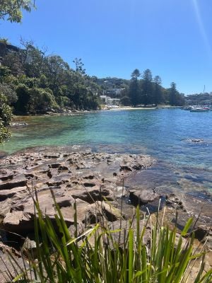
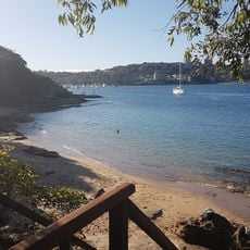
The Manly to Spit Bridge Walk is a hiking trail along Sydney Harbour's northern shore with views of the water and surrounding nature. The path spans about 10 kilometers through small beaches, bushland, and rocky outcrops, with some gentle inclines and marked sections that detour during high tide.

History

The trail is located in an area long used by Indigenous peoples for fishing and travel along the waterways. European settlement later left traces of stone walls and early dwellings visible near the path, marking the shift in how this land was used over time.

Culture

The trail passes through land traditionally used by the Gadigal people of the Eora nation. Visitors today encounter Aboriginal engravings at Grotto Point, where carved animals and tools in sandstone tell stories of Indigenous presence over many centuries.

Practical

Bring water and sun protection as much of the trail is exposed to strong sun. Start early in the day or later in the afternoon to avoid midday heat, and wear comfortable shoes for the mix of footpaths, bush tracks, and beaches.

Did you know?

The trail features Grotto Point Lighthouse, an old lighthouse perched on rocky cliffs that has guided ships for many years. From nearby viewpoints like Arabanoo Lookout, visitors sometimes spot dolphins in the water, and passing whales can be seen during certain seasons.

Inception
January 1, 1988
Address
Reef Beach Track, Balgowlah Heights NSW 2093, Australia
GPS coordinates
-33.80544,151.26780
Latest update
January 28, 2026 10:23

AroundUs brings together thousands of curated places, local tips, and hidden gems, enriched daily by 60,000 contributors worldwide. Discover all places nearby (Balgowlah Heights).

New South Wales: tourist sites, beaches, and parks in Australia

New South Wales combines very different landscapes, from beaches along the coast to wooded mountains and inland plateaus. This collection includes about thirty sites that show this variety: Sydney with its internationally known buildings, geological formations protected by UNESCO like the Blue...

« Manly to Spit Bridge Walk » is provided by Around Us (aroundus.com). Images and texts are derived from Wikimedia project under a Creative Commons license. You are allowed to copy, distribute, and modify copies of this page, under the conditions set by the license, as long as this note is clearly visible.

Discover hidden gems everywhere you go!

From secret cafés to breathtaking viewpoints, skip the crowded tourist spots and find places that match your style. Our app makes it easy with voice search, smart filtering, route optimization, and insider tips from travelers worldwide. Download now for the complete mobile experience.

Around Us App Screenshot

A unique approach to discovering new places

Le Figaro

All the places worth exploring

France Info

A tailor-made excursion in just a few clicks

20 Minutes

Around Us
Travel Guide & Maps
Download

Send to your phone

QR Code
1

Open the camera app on your mobile.

2

Point at the QR code with your camera. A notification will appear.

3

Tap the notification to open the link.