Enable Location

We need your location to show you interesting places around you

Discover nearby places

Find interesting locations and hidden gems around you

Precise directions

Get accurate directions and distances to places

Your location is never shared with other users. It's only used when you tap the location button.

Routeburn Nature Walk

Log in to your account

Start exploring — it's free

Trusted by 61,408 travelers worldwide

Continue with Google
Continue with Apple
or

We will send you a code to connect

By continuing, you accept our Terms and Conditions and our Privacy Policy

Check your inbox

We've sent a pincode in your inbox. Please enter the code below.

Routeburn Nature Walk

Routeburn Nature Walk

Description

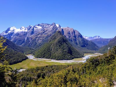
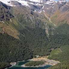
The Routeburn Nature Walk is an easy forest trail in Mount Aspiring National Park near Queenstown that passes through native beech forests and open meadows. The path crosses swingbridges over streams and is clearly marked with signs and wooden posts throughout.

History

The area was long used by early Maori inhabitants of New Zealand who gathered resources and traveled ancient trade routes here. The modern trail partly follows these historical pathways that have connected communities for centuries.

Culture

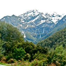
The trail passes through forests that have long been part of Maori lands, with names of trees and places reflecting this connection to the landscape. Native trees like red beech and tawhai remain central to local identity and shape how visitors experience the walk.

Practical

The trail is flat and easy to follow, suitable for families and visitors of all ages who should bring sturdy walking shoes and water. After rain the ground becomes muddy, so good footwear is essential, and checking weather conditions before heading out is wise.

Did you know?

The path connects with the famous Routeburn Track, a multi-day hiking route, giving visitors a gentle taste of the more challenging experience. This gateway allows day hikers to explore the landscape without committing to a multi-day expedition.

Address
Westland District, Otago Region 9372, New Zealand
GPS coordinates
-44.71454,168.27110
Latest update
January 30, 2026 12:17

AroundUs brings together thousands of curated places, local tips, and hidden gems, enriched daily by 60,000 contributors worldwide. Discover all places nearby (Queenstown-Lakes District).

South Island New Zealand: fjords, glaciers, vineyards

New Zealand's South Island has many places that show the variety of this region in the South Pacific. The landscapes range from the deep fjords of Milford Sound to the glaciers of Fox and Franz Josef, from the snowy peaks of Aoraki/Mount Cook to the golden beaches of Abel Tasman. Towns like...

« Routeburn Nature Walk » is provided by Around Us (aroundus.com). Images and texts are derived from Wikimedia project under a Creative Commons license. You are allowed to copy, distribute, and modify copies of this page, under the conditions set by the license, as long as this note is clearly visible.

Discover hidden gems everywhere you go!

From secret cafés to breathtaking viewpoints, skip the crowded tourist spots and find places that match your style. Our app makes it easy with voice search, smart filtering, route optimization, and insider tips from travelers worldwide. Download now for the complete mobile experience.

Around Us App Screenshot

A unique approach to discovering new places

Le Figaro

All the places worth exploring

France Info

A tailor-made excursion in just a few clicks

20 Minutes

Around Us
Travel Guide & Maps
Download

Send to your phone

QR Code
1

Open the camera app on your mobile.

2

Point at the QR code with your camera. A notification will appear.

3

Tap the notification to open the link.