Komáří hůrka

Log in to your account

AroundUs is a community-driven map of interesting places, built by curious explorers like you. It grows with every review, story, and photo you share.
Connect to save your favorite spots, contribute locations, and create personalized routes.
Continue with Google
Continue with Apple
Continue with X
Continue with Facebook
Continue with email
By continuing, you accept our Terms and Conditions and our Privacy Policy
Create an account

Komáří hůrka

Add to collection
Map
Suggest a change
Share

Komáří hůrka, Mountain summit in Krupka, Czech Republic

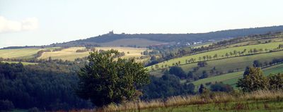
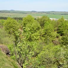
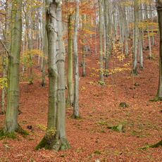
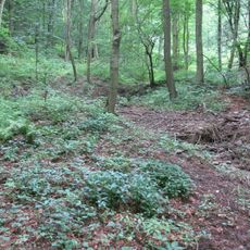
Komáří hůrka is a mountain in the Eastern Ore Mountains standing at about 807 meters with steep slopes that drop sharply to the south. It is composed of orthogneiss and porphyry, forming a prominent feature in the landscape around Krupka.

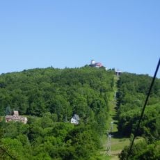
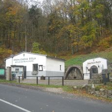
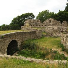
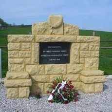
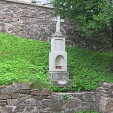
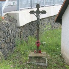
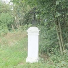
Mining on this mountain began centuries ago, driven by tin and other mineral deposits. It gradually transformed into a recreation destination when a restaurant was built there in the middle of the 19th century.

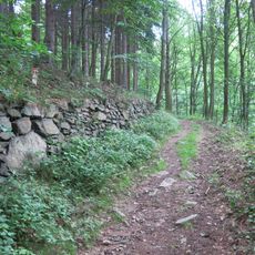
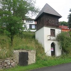
The mountain serves as a meeting place where visitors come to enjoy views and eat at local restaurants. The walking paths and rest areas show how this location shifted from a working site to a recreational destination.

A chairlift runs from the valley floor to the summit, making the ascent easy and accessible for most visitors. Walking trails of various difficulty levels crisscross the mountain, offering options for different interests and abilities.

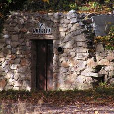
Beneath the surface lie old mining shafts and bell pits dating back to medieval extraction work. These underground tunnels are a hidden reminder of how intensively this mountain was worked over the centuries.

Location: Krupka

Elevation above the sea: 807.5 m

Made from material: orthogneiss, porphyry

GPS coordinates: 50.70662,13.85645

Latest update: December 10, 2025 16:24

Photos
Around this place
Chairlift Bohosudov - Komáří vížka
Czech Republic

Chairlift Bohosudov - Komáří vížka

2.4 km
Church of the Assumption of the Virgin Mary
Czech Republic

Church of the Assumption of the Virgin Mary

2.3 km
Mining cultural landscape Krupka
Czech Republic

Mining cultural landscape Krupka

1.1 km
Štola Starý Martin
Czech Republic

Štola Starý Martin

1.2 km
Velká pinka na Komáří hůrce
Czech Republic

Velká pinka na Komáří hůrce

159 m
Revír Knötel
Czech Republic

Revír Knötel

1.6 km
Římskokatolická farnost Krupka
Czech Republic

Římskokatolická farnost Krupka

2.3 km
Hornická stezka
Czech Republic

Hornická stezka

1 km
Statue of Francis Xavier in Krupka
Czech Republic

Statue of Francis Xavier in Krupka

2.2 km
Východní Krušnohoří
Czech Republic

Východní Krušnohoří

1.7 km
Naučná stezka Po stopách horníků
Czech Republic

Naučná stezka Po stopách horníků

2.3 km
Chapel of Saint Wolfgang (Komáří hůrka)
Czech Republic

Chapel of Saint Wolfgang (Komáří hůrka)

277 m
Pomník doktora Ferdinanda Arlta v Krupce
Czech Republic

Pomník doktora Ferdinanda Arlta v Krupce

2.3 km
Dům čp. 21
Czech Republic

Dům čp. 21

2.2 km
Socha svatého Jana Nepomuckého u kostela Nanebevzetí v Krupce
Czech Republic

Socha svatého Jana Nepomuckého u kostela Nanebevzetí v Krupce

2.3 km
Památník obětem pochodu smrti severně od Fojtovic
Czech Republic

Památník obětem pochodu smrti severně od Fojtovic

1.6 km
Dům čp. 24
Czech Republic

Dům čp. 24

2.2 km
Sejpy haldy
Czech Republic

Sejpy haldy

2.2 km
Polodřevěná zvonice v Horní Krupce
Czech Republic

Polodřevěná zvonice v Horní Krupce

421 m
Kaplička se sochou Piety u kostela Nanebevzetí v Krupce
Czech Republic

Kaplička se sochou Piety u kostela Nanebevzetí v Krupce

2.3 km
Pomník padlému rudoarmějci severně od Fojtovic
Czech Republic

Pomník padlému rudoarmějci severně od Fojtovic

1.6 km
Kříž zvaný Goldammerův u cesty z Horní Krupky do Habartic
Czech Republic

Kříž zvaný Goldammerův u cesty z Horní Krupky do Habartic

788 m
Church of the Assumption of the Virgin Mary
Czech Republic

Church of the Assumption of the Virgin Mary

2.3 km
Kříž v Horní Krupce
Czech Republic

Kříž v Horní Krupce

409 m
Infocentrum hornické krajiny Krupka
Czech Republic

Infocentrum hornické krajiny Krupka

2.2 km
Kříž v Horní Krupce u odbočky na starou hornickou stezku
Czech Republic

Kříž v Horní Krupce u odbočky na starou hornickou stezku

476 m
Kříž u rozcestí na Komáří vížku nad Fojtovicemi
Czech Republic

Kříž u rozcestí na Komáří vížku nad Fojtovicemi

287 m
Kříž v Husitské ulici v horní části Krupky
Czech Republic

Kříž v Husitské ulici v horní části Krupky

1.6 km
Show the full map
Reviews

Visited this place? Tap the stars to rate it and share your experience / photos with the community! Try now! You can cancel it anytime.

« Komáří hůrka - Mountain summit in Krupka, Czech Republic » is provided by Around Us (aroundus.com). Images and texts are derived from Wikimedia project under a Creative Commons license. You are allowed to copy, distribute, and modify copies of this page, under the conditions set by the license, as long as this note is clearly visible.

Discover hidden gems everywhere you go!

From secret cafés to breathtaking viewpoints, skip the crowded tourist spots and find places that match your style. Our app makes it easy with voice search, smart filtering, route optimization, and insider tips from travelers worldwide. Download now for the complete mobile experience.

Around Us App Screenshot

A unique approach to discovering new places

Le Figaro

All the places worth exploring

France Info

A tailor-made excursion in just a few clicks

20 Minutes