Chest opened
+${chestReward.xp} XP
Explorer
NOUVEAU ×${chestReward.collectible.quantity}
tapez pour fermer
Chest locked

Open chests in the app

Around Us is built for your phone — chests unlock when you walk, explore and capture nearby places.

Enable Location

We need your location to show you interesting places around you

Discover nearby places

Find interesting locations and hidden gems around you

Precise directions

Get accurate directions and distances to places

Your location is never shared with other users. It's only used when you tap the location button.

D3 motorway

Log in to your account

Start exploring — it's free

Trusted by 72,890 travelers worldwide

Continue with Google
Continue with Apple
or

We will send you a code to connect

By continuing, you accept our Terms and Conditions and our Privacy Policy

Check your inbox

We've sent a pincode in your inbox. Please enter the code below.

D3 motorway
Discussion Reviews 1 Photos
27.9k Popularity

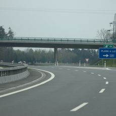
D3 motorway, Controlled-access highway in Central Bohemian Region, Czech Republic.

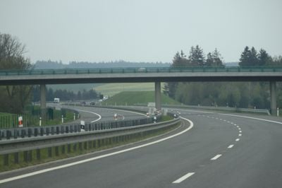
The D3 is a controlled-access highway connecting Prague with the Austrian border at Dolní Dvořiště, passing through several major towns. It travels across changing landscapes between central and southern Bohemia.

Construction of this highway began with segments near Tábor and expanded gradually over time. The route developed in stages to link central and southern areas of the country.

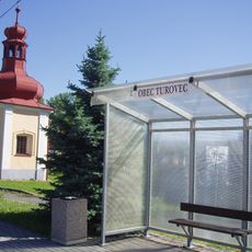
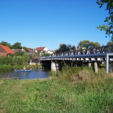
The highway links communities across regions and facilitates movement between central and southern areas of the country. Travelers notice how this corridor shapes connections between different parts of Bohemia.

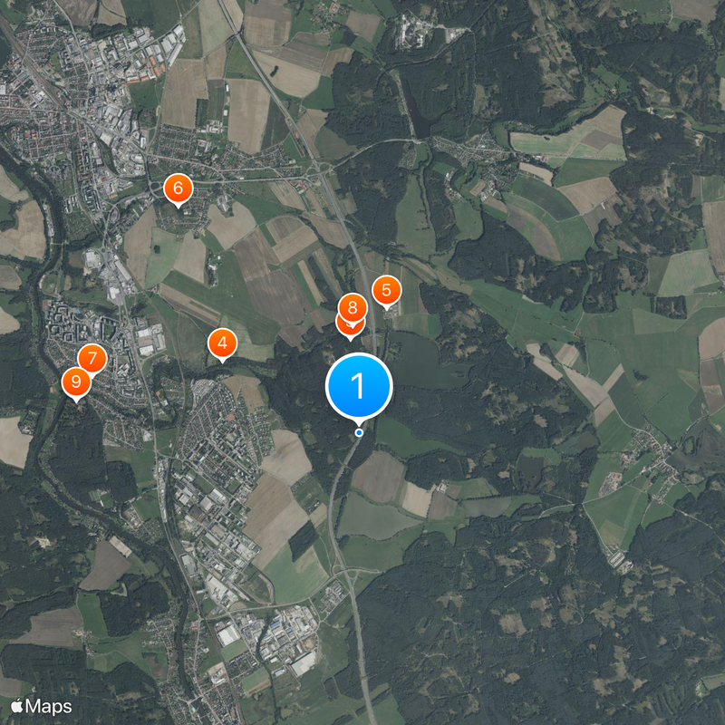
Currently about 69 kilometers between Mezno and Úsilné are operational, with additional sections planned for completion. Travelers should expect construction work and check for alternative routes.

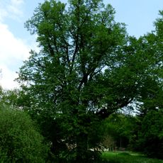
The planned route through the Lower Sázava area sparked extensive discussions about environmental protection. These debates show how modern infrastructure projects must address local concerns.

The community of curious travelers

AroundUs brings together thousands of curated places, local tips, and hidden gems, enriched daily by 60,000 contributors worldwide.

Start exploring
Part of
European route E55
GPS coordinates
49.37980,14.72426
Latest update
December 20, 2025 13:13
Around this place
Beneš villa
Czech Republic

Beneš villa

3 km
Kozí Hrádek
Czech Republic

Kozí Hrádek

1 km
Luna
Czech Republic

Luna

1.7 km
Červený Dvůr (Sezimovo Ústí)
Czech Republic

Červený Dvůr (Sezimovo Ústí)

1.4 km
Lom Svatá Anna
Czech Republic

Lom Svatá Anna

3.1 km
Church of the Exaltation of the Holy Cross
Czech Republic

Church of the Exaltation of the Holy Cross

2.9 km
Průchod na Kozím hrádku
Czech Republic

Průchod na Kozím hrádku

1.1 km
Vila - areál vil Dr. Edvarda Beneše, Strimplovy a Fierlingerovy se zahradou
Czech Republic

Vila - areál vil Dr. Edvarda Beneše, Strimplovy a Fierlingerovy se zahradou

3 km
Památník mohyla u Kozího Hrádku
Czech Republic

Památník mohyla u Kozího Hrádku

1.1 km
Bridge over Kozský potok near Kozský
Czech Republic

Bridge over Kozský potok near Kozský

2.1 km
Most ulice Dr. E. Beneše přes Kozský potok v Sezimově Ústí
Czech Republic

Most ulice Dr. E. Beneše přes Kozský potok v Sezimově Ústí

3 km
Jasan v Sezimově Ústí
Czech Republic

Jasan v Sezimově Ústí

1.7 km
Venkovská usedlost
Czech Republic

Venkovská usedlost

3.1 km
Návesní kaple svatého Jana Nepomuckého
Czech Republic

Návesní kaple svatého Jana Nepomuckého

3.3 km
Lípa u Nechyby
Czech Republic

Lípa u Nechyby

617 m
Kaple svaté Anny
Czech Republic

Kaple svaté Anny

3 km
Bridge of road II/409 over D3 highway in Planá nad Lužnicí
Czech Republic

Bridge of road II/409 over D3 highway in Planá nad Lužnicí

1.5 km
Podchod v železniční stanici Sezimovo Ústí
Czech Republic

Podchod v železniční stanici Sezimovo Ústí

1.9 km
Symbol míru
Czech Republic

Symbol míru

3.1 km
Lávka přes Lužnici u Sezimova Ústí
Czech Republic

Lávka přes Lužnici u Sezimova Ústí

3.2 km
Kaplička v Turovci
Czech Republic

Kaplička v Turovci

3.2 km
Lávka vedle mostu ulice Dr. E. Beneše přes Kozský potok v Sezimově Ústí
Czech Republic

Lávka vedle mostu ulice Dr. E. Beneše přes Kozský potok v Sezimově Ústí

2.9 km
Pomník padlým v Zárybničné Lhotě
Czech Republic

Pomník padlým v Zárybničné Lhotě

3.3 km
Kaple v Zárybničné Lhotě
Czech Republic

Kaple v Zárybničné Lhotě

3.1 km
Kaplička severně od Turovce
Czech Republic

Kaplička severně od Turovce

2.2 km
Most přes Kozský potok u Ozvěny
Czech Republic

Most přes Kozský potok u Ozvěny

1.2 km
Lávka přes silnici I/3 v Sezimově Ústí
Czech Republic

Lávka přes silnici I/3 v Sezimově Ústí

2.2 km
Lávka červeně značené trasy přes potok od rybníka Plocko
Czech Republic

Lávka červeně značené trasy přes potok od rybníka Plocko

1 km
Show the full map
Reviews
Share your experience

No review yet

Discussions
Start a discussion...

No discussion yet

« D3 motorway - Controlled-access highway in Central Bohemian Region, Czech Republic » is provided by Around Us (aroundus.com). Images and texts are derived from Wikimedia project under a Creative Commons license. You are allowed to copy, distribute, and modify copies of this page, under the conditions set by the license, as long as this note is clearly visible.

Discover hidden gems everywhere you go!

From secret cafés to breathtaking viewpoints, skip the crowded tourist spots and find places that match your style. Our app makes it easy with voice search, smart filtering, route optimization, and insider tips from travelers worldwide. Download now for the complete mobile experience.

Around Us App Screenshot

A unique approach to discovering new places

Le Figaro

All the places worth exploring

France Info

A tailor-made excursion in just a few clicks

20 Minutes

Around Us
Travel Guide & Maps
Download

Send to your phone

QR Code
1

Open the camera app on your mobile.

2

Point at the QR code with your camera. A notification will appear.

3

Tap the notification to open the link.