Žďár nad Sázavou

Log in to your account

AroundUs is a community-driven map of interesting places, built by curious explorers like you. It grows with every review, story, and photo you share.
Connect to save your favorite spots, contribute locations, and create personalized routes.
Continue with Google
Continue with Apple
Continue with X
Continue with Facebook
Continue with email
By continuing, you accept our Terms and Conditions and our Privacy Policy
Create an account
Add to collection
Map
Suggest a change
Share

Žďár nad Sázavou, District town in Vysočina Region, Czech Republic

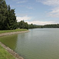
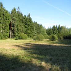
Žďár nad Sázavou is a town in the Vysočina Region situated on a highland plateau between Bohemia and Moravia. The municipal area covers a substantial territory, with the town center as the focus point and surrounding neighborhoods forming an extended settlement pattern.

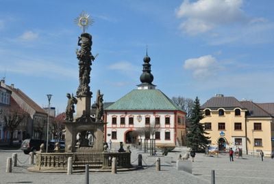
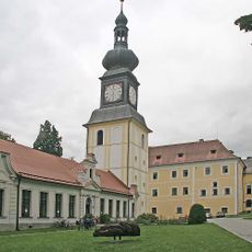
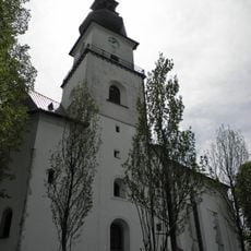
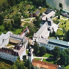
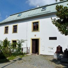
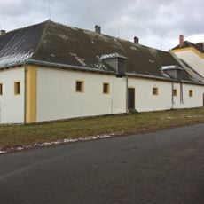
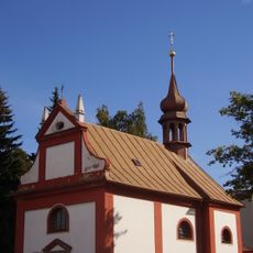
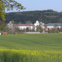
A Cistercian monastery was established here in the early 13th century, forming the foundation for the settlement that grew around it. Urban rights granted in the 17th century transformed the place into a regional administrative center.

The former monastery complex shapes how people experience the center of town and connects residents to their religious past. Local celebrations and the presence of the church continue to mark the calendar and give the place its character.

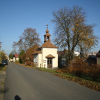
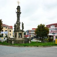
The town is well connected by train and bus, serving as a hub linking nearby villages to larger cities. Visitors will find local shops, restaurants, and services typical of a town this size, making it easy to navigate and spend a few hours exploring.

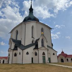
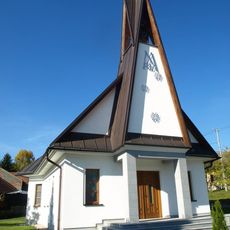
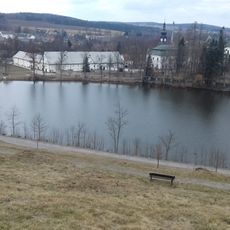
The Baroque pilgrimage church dedicated to Saint John of Nepomuk is recognized as a UNESCO World Heritage site and displays an unusual geometric design. This building stands out as one of the most important architectural works of its era and draws visitors from far and wide.

Location: Žďár nad Sázavou District

Location: upravni občinski okoliš z razširjenimi pristojnostmi Žďár nad Sázavou

Elevation above the sea: 580 m

Reference: CZ0635595209

Shares border with: Račín, Počítky, Polnička, Světnov, Vatín, Vysoké, Březí nad Oslavou, Hamry nad Sázavou, Jámy, Nové Veselí, Nové Město na Moravě, Sázava, Lhotka, Budeč

Email: informace@zdarns.cz

Website: https://zdarns.cz

GPS coordinates: 49.56267,15.93928

Latest update: December 17, 2025 10:20

Photos
Reviews

Visited this place? Tap the stars to rate it and share your experience / photos with the community! Try now! You can cancel it anytime.

« Žďár nad Sázavou - District town in Vysočina Region, Czech Republic » is provided by Around Us (aroundus.com). Images and texts are derived from Wikimedia project under a Creative Commons license. You are allowed to copy, distribute, and modify copies of this page, under the conditions set by the license, as long as this note is clearly visible.

Discover hidden gems everywhere you go!

From secret cafés to breathtaking viewpoints, skip the crowded tourist spots and find places that match your style. Our app makes it easy with voice search, smart filtering, route optimization, and insider tips from travelers worldwide. Download now for the complete mobile experience.

Around Us App Screenshot

A unique approach to discovering new places

Le Figaro

All the places worth exploring

France Info

A tailor-made excursion in just a few clicks

20 Minutes