Slapy Reservoir, Water reservoir in Štěchovice, Czech Republic
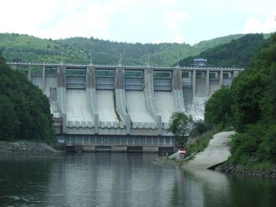
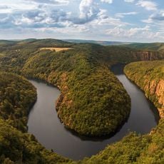
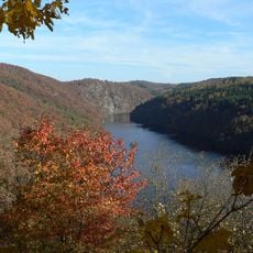
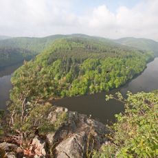
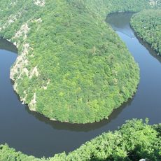
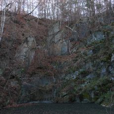
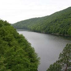
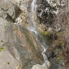
Slapy Reservoir is a reservoir on the Vltava River northeast of Štěchovice in the Czech Republic, stretching over more than twelve kilometers in length. The dammed water lies behind a barrier that powers three turbines in a wooded valley and forms several bays with rocky and forested shores.
The dam was built between 1949 and 1955 as part of modernizing the Vltava for energy production and flood control. Heavy floods in 1954 filled the basin ahead of schedule, before all construction work was finished.
This reservoir takes its name from the nearby settlement of Slapy and has offered space for activities like sailing and fishing since the 1950s. Small holiday cottage communities have grown along the banks, turning the river valley into a weekend retreat.
Visitors will find four public camping areas along the shores as well as several small beaches and swimming spots. Access is possible at many points, with narrow roads through the forest leading to parking near the water.
The water reaches more than fifty meters at its deepest point, making it one of the deeper reservoirs in Central Europe. When the water level drops, the outlines of submerged villages and old bridges that were flooded during construction sometimes become visible.
Location: Štěchovice
Location: Hříměždice
Inception: 1952
Elevation above the sea: 271 m
GPS coordinates: 49.82370,14.43410
Latest update: December 5, 2025 22:29
Vyhlídka Máj
1.8 km
Štěchovice Reservoir
2.9 km
Smetanova vyhlídka
3.1 km
Prírodný park Střed Čech
2.3 km
Teletínský lom
3 km
Church of Saints Peter and Paul in Slapy
2.8 km
Vysoký Újezd - kostel
3.1 km
Kobylí draha
3 km
Kletecký vodopád
3 km
Statue of Saint John of Nepomuk at Svatojánské proudy
385 m
Ferdinand Column at Svatojánské proudy
234 m
Church of the Nativity of the Virgin Mary
3.1 km
Chapel of the Assumption
2.7 km
Zámek Slapy
3 km
Kaplička se sochou svatého Jana Nepomuckého
2.3 km
XIV. zastavení křížové cesty ve Štěchovicích
3.4 km
Kříž u kaple Nanebevzetí Panny Marie Na Rovínku
901 m
Socha v ulici Na Buku ve Štěchovicích
3.4 km
Vysoký Újezd - kostel
3.1 km
Kaple Nanebevzetí Panny Marie Na Rovínku
891 m
Kříž pod kostelem ve Štěchovicích
3.4 km
Turbína u elektrárny ve Štěchovicích
2.8 km
Kříž před kostelem Narození Panny Marie ve Vysokém Újezdě
3.1 km
Pomník Obětem 1. světové války ve Vysokém Újezdě
3.1 km
V. zastavení křížové cesty ve Štěchovicích
3.4 km
IV. zastavení křížové cesty ve Štěchovicích
3.4 km
III. zastavení křížové cesty ve Štěchovicích
3.4 km
Kaple ve Slapech nad Vltavou
2.8 kmVisited this place? Tap the stars to rate it and share your experience / photos with the community! Try now! You can cancel it anytime.
Discover hidden gems everywhere you go!
From secret cafés to breathtaking viewpoints, skip the crowded tourist spots and find places that match your style. Our app makes it easy with voice search, smart filtering, route optimization, and insider tips from travelers worldwide. Download now for the complete mobile experience.
A unique approach to discovering new places❞
— Le Figaro
All the places worth exploring❞
— France Info
A tailor-made excursion in just a few clicks❞
— 20 Minutes