Enable Location

We need your location to show you interesting places around you

Discover nearby places

Find interesting locations and hidden gems around you

Precise directions

Get accurate directions and distances to places

Your location is never shared with other users. It's only used when you tap the location button.

Rožnov pod Radhoštěm

Log in to your account

Start exploring — it's free

Trusted by 61,692 travelers worldwide

Continue with Google
Continue with Apple
or

We will send you a code to connect

By continuing, you accept our Terms and Conditions and our Privacy Policy

Check your inbox

We've sent a pincode in your inbox. Please enter the code below.

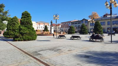
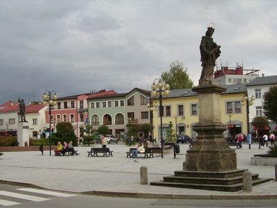
Rožnov pod Radhoštěm, Mountain town in Vsetín District, Czech Republic

Description

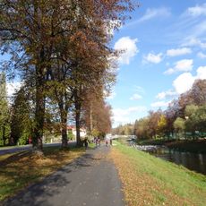
Rožnov pod Radhoštěm is a town in the Vsetín District set in the valley of the Rožnovská Bečva River, surrounded by the Moravian-Silesian Beskids mountains at about 378 meters elevation. The location makes it a natural starting point for exploring the forested hills and mountain trails in the region.

History

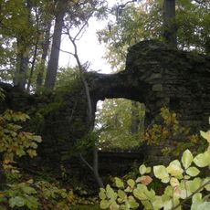
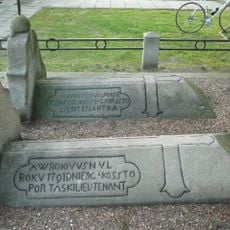
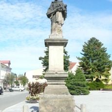
The town began in 1267 during a wave of colonization, with a castle documented on Hradisko hill by 1310. From these early foundations, it grew into an important center for regional trade and crafts.

Culture

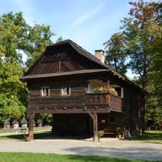
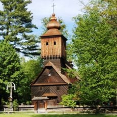
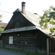
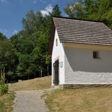
The Wallachian Open Air Museum displays how people in this region lived and built their homes in earlier times. Walking through its three sections reveals traditional houses, crafts, and the daily practices that shaped community life.

Practical

The town sits conveniently near hiking routes and transport connections into the surrounding mountains. Pustevny, a popular base for mountain outings, is easy to reach by bus or on foot.

Did you know?

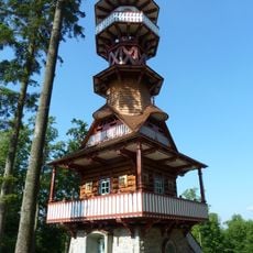
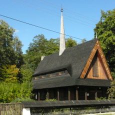
The Jurkovič Tower on Charles Hill was built in 2012 following original designs by Slovak architect Dušan Jurkovič, offering views across the mountain landscape. The structure brings together historical architectural principles with contemporary construction.

Location
Inception
October 1, 1980
Elevation above the sea
378 m
Reference
CZ0723544841
Shares border with
Hutisko-Solanec, Dolní Bečva, Trojanovice, Veřovice, Zubří, Vigantice, Vidče, Valašská Bystřice
GPS coordinates
49.45852,18.14305
Latest update
December 20, 2025 15:30

AroundUs brings together thousands of curated places, local tips, and hidden gems, enriched daily by 60,000 contributors worldwide. Discover all places nearby (Vsetín District).

Around this place
Jurkovičova rozhledna
Czech Republic

Jurkovičova rozhledna

1.2 km
National Open-air Museum
Czech Republic

National Open-air Museum

553 m
Rožnov
Czech Republic

Rožnov

1.7 km
Church in Valašské muzeum v přírodě
Czech Republic

Church in Valašské muzeum v přírodě

639 m
Church of All Saints (Rožnov pod Radhoštěm)
Czech Republic

Church of All Saints (Rožnov pod Radhoštěm)

212 m
Evangelical church
Czech Republic

Evangelical church

440 m
Church of the Assumption of the Virgin Mary
Czech Republic

Church of the Assumption of the Virgin Mary

5.4 km
Czech Republic

Paláčkův mlýn

125 m
Czech Republic

Český svaz muzeí v přírodě

476 m
Bust of František Palacký
Czech Republic

Bust of František Palacký

159 m
Saint Anthony of Padua Church
Czech Republic

Saint Anthony of Padua Church

3.6 km
Czech Republic

Most Palackého ulice přes Rožnovskou Bečvu v Rožnově pod Radhoštěm

1.2 km
Statues of Saint John of Nepomuk and Saint Florian in Rožnov pod Radhoštěm
Czech Republic

Statues of Saint John of Nepomuk and Saint Florian in Rožnov pod Radhoštěm

89 m
Czech Republic

Lávka přes Rožnovskou Bečvu v Rožnově pod Radhoštěm vedle mostu Palackého ulice

1.2 km
Lávka přes Rožnovskou Bečvu do městského sadu v Rožnově pod Radhoštěm
Czech Republic

Lávka přes Rožnovskou Bečvu do městského sadu v Rožnově pod Radhoštěm

392 m
Statue of Saint Florian
Czech Republic

Statue of Saint Florian

85 m
Czech Republic

Lávka přes Rožnovskou Bečvu v Rožnově pod Radhoštěm vedle mostu Nádražní ulice

378 m
Zvonice
Czech Republic

Zvonice

2.2 km
Dva hroby portášů
Czech Republic

Dva hroby portášů

5.4 km
Venkovská usedlost
Czech Republic

Venkovská usedlost

1.7 km
Statue of Tomáš Garrigue Masaryk
Czech Republic

Statue of Tomáš Garrigue Masaryk

54 m
Fara
Czech Republic

Fara

3.6 km
Statue of John of Nepomuk (Rožnov pod Radhoštěm, Masarykovo náměstí)
Czech Republic

Statue of John of Nepomuk (Rožnov pod Radhoštěm, Masarykovo náměstí)

93 m
Chapel of Saint Michael
Czech Republic

Chapel of Saint Michael

1 km
Czech Republic

Krucifix

2.5 km
Czech Republic

Most ulice Bučiska přes Rožnovskou Bečvu

1.1 km
Tyršovo nábřeží
Czech Republic

Tyršovo nábřeží

759 m
Nábřeží Dukelských hrdinů
Czech Republic

Nábřeží Dukelských hrdinů

810 m
Show the full map
« Rožnov pod Radhoštěm - Mountain town in Vsetín District, Czech Republic » is provided by Around Us (aroundus.com). Images and texts are derived from Wikimedia project under a Creative Commons license. You are allowed to copy, distribute, and modify copies of this page, under the conditions set by the license, as long as this note is clearly visible.

Discover hidden gems everywhere you go!

From secret cafés to breathtaking viewpoints, skip the crowded tourist spots and find places that match your style. Our app makes it easy with voice search, smart filtering, route optimization, and insider tips from travelers worldwide. Download now for the complete mobile experience.

Around Us App Screenshot

A unique approach to discovering new places

Le Figaro

All the places worth exploring

France Info

A tailor-made excursion in just a few clicks

20 Minutes

Around Us
Travel Guide & Maps
Download

Send to your phone

QR Code
1

Open the camera app on your mobile.

2

Point at the QR code with your camera. A notification will appear.

3

Tap the notification to open the link.