Enable Location

We need your location to show you interesting places around you

Discover nearby places

Find interesting locations and hidden gems around you

Precise directions

Get accurate directions and distances to places

Your location is never shared with other users. It's only used when you tap the location button.

Rataje nad Sázavou

Log in to your account

Start exploring — it's free

Trusted by 61,632 travelers worldwide

Continue with Google
Continue with Apple
or

We will send you a code to connect

By continuing, you accept our Terms and Conditions and our Privacy Policy

Check your inbox

We've sent a pincode in your inbox. Please enter the code below.

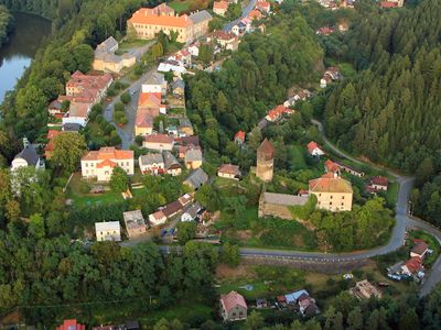
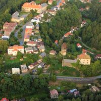
Rataje nad Sázavou, Medieval market town in Kutná Hora District, Czech Republic.

Description

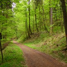
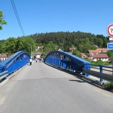
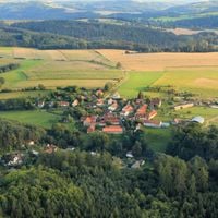
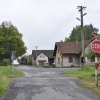
Rataje nad Sázavou is a settlement in the Kutná Hora District that stretches along the right bank of the Sázava River. It sits at an elevation of 383 meters (1,256 feet) within the Vlašim Uplands, where rolling terrain and scattered vegetation shape the local landscape.

History

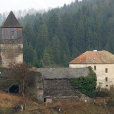
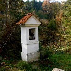
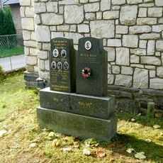
The settlement appeared in written records in 1156 as a fortified market town with a border fortress. This early documentation reflects its strategic importance during the medieval period.

Culture

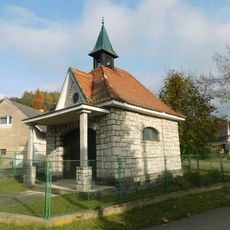
The Church of Saint Matthew, constructed between 1675 and 1691, represents early Baroque architecture and maintains its original design elements.

Practical

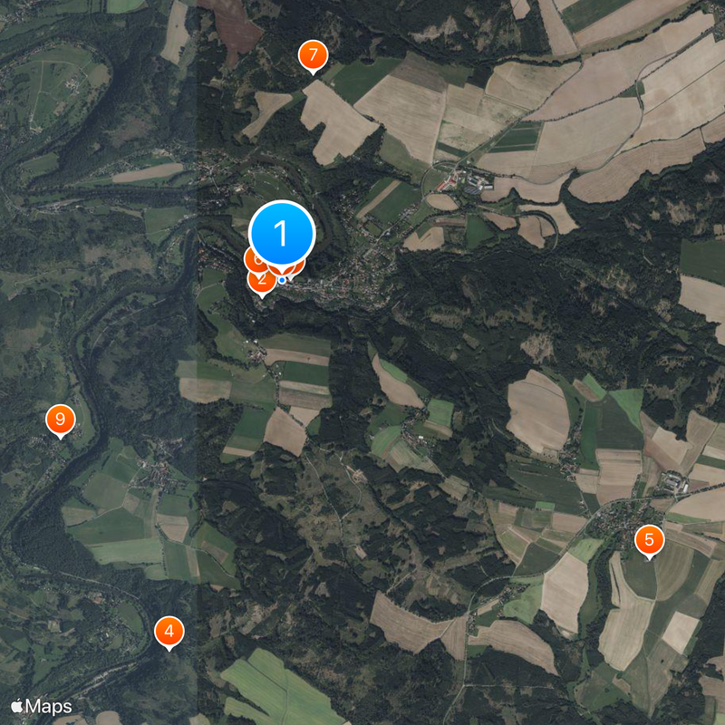
The town connects to regional railway networks through several stations that link to nearby cities such as Kolín, Ledeč nad Sázavou, and Čerčany. This makes it accessible for visitors arriving by train from surrounding areas.

Did you know?

The settlement appears as a historical setting in the video game Kingdom Come: Deliverance, depicting its medieval appearance from 1403. This digital representation allows visitors to recognize the familiar landscape when visiting in person.

Elevation above the sea
383 m
Reference
CZ0205534358
Shares border with
Úžice, Český Šternberk, Sázava, Staňkovice, Drahňovice, Ledečko, Zbizuby, Soběšín, Samopše, Uhlířské Janovice, Podveky
GPS coordinates
49.84191,14.95678
Latest update
December 20, 2025 15:20

AroundUs brings together thousands of curated places, local tips, and hidden gems, enriched daily by 60,000 contributors worldwide. Discover all places nearby (Kutná Hora District).

Around this place
Pirkštejn
Czech Republic

Pirkštejn

194 m
Rataje nad Sázavou Castle
Czech Republic

Rataje nad Sázavou Castle

71 m
Na Stříbrné
Czech Republic

Na Stříbrné

3 km
Church of Saint Gall
Czech Republic

Church of Saint Gall

3.6 km
Church of Saint Matthew
Czech Republic

Church of Saint Matthew

179 m
Jubilejní památník knížete Jana II. z Lichtenštejna v Ratajích
Czech Republic

Jubilejní památník knížete Jana II. z Lichtenštejna v Ratajích

1.6 km
Sousoší svatého Jana Nepomuckého v Ratajích
Czech Republic

Sousoší svatého Jana Nepomuckého v Ratajích

11 m
Czech Republic

Most cesty Poříčko - Čeřenice přes Křešický potok

2.1 km
Chapel of Saint Wenceslaus
Czech Republic

Chapel of Saint Wenceslaus

1.3 km
City walls in Rataje nad Sázavou
Czech Republic

City walls in Rataje nad Sázavou

174 m
Kříž
Czech Republic

Kříž

3.3 km
Chapel of Saint Anthony
Czech Republic

Chapel of Saint Anthony

752 m
Památník obětem obou světových válek a komunismu v Ratajích
Czech Republic

Památník obětem obou světových válek a komunismu v Ratajích

460 m
Road bridge over the Sázava in Ledečko
Czech Republic

Road bridge over the Sázava in Ledečko

926 m
Most přes Křešický potok v Poříčku
Czech Republic

Most přes Křešický potok v Poříčku

2.1 km
Reliéfy v hřbitovní zdi u kostela v Ratajích
Czech Republic

Reliéfy v hřbitovní zdi u kostela v Ratajích

159 m
Zvonička v Podvecích
Czech Republic

Zvonička v Podvecích

3.3 km
Pomník padlým v Podvecích
Czech Republic

Pomník padlým v Podvecích

3.5 km
Kaplička u silnice jihovýchodně od Ratají
Czech Republic

Kaplička u silnice jihovýchodně od Ratají

1.2 km
Kříž v centru Podvek
Czech Republic

Kříž v centru Podvek

3.3 km
Kříž v Zalíbené
Czech Republic

Kříž v Zalíbené

3 km
Plastika Pirkenštejský ptáček v předzámčí v Ratajích
Czech Republic

Plastika Pirkenštejský ptáček v předzámčí v Ratajích

36 m
Kříž u domu č. 60 v Podvecích
Czech Republic

Kříž u domu č. 60 v Podvecích

3.5 km
Zvonička v Ježovicích
Czech Republic

Zvonička v Ježovicích

2.6 km
Hřbitov Podveky
Czech Republic

Hřbitov Podveky

3.6 km
Kaple svaté Anny v Ledečku
Czech Republic

Kaple svaté Anny v Ledečku

1 km
Pomník padlým v Ledečku
Czech Republic

Pomník padlým v Ledečku

1 km
Sloup svatého Prokopa u křižovatky silnic "Na Vítkovicích" severně od Ratají nad Sázavou
Czech Republic

Sloup svatého Prokopa u křižovatky silnic "Na Vítkovicích" severně od Ratají nad Sázavou

1.7 km
Show the full map
« Rataje nad Sázavou - Medieval market town in Kutná Hora District, Czech Republic » is provided by Around Us (aroundus.com). Images and texts are derived from Wikimedia project under a Creative Commons license. You are allowed to copy, distribute, and modify copies of this page, under the conditions set by the license, as long as this note is clearly visible.

Discover hidden gems everywhere you go!

From secret cafés to breathtaking viewpoints, skip the crowded tourist spots and find places that match your style. Our app makes it easy with voice search, smart filtering, route optimization, and insider tips from travelers worldwide. Download now for the complete mobile experience.

Around Us App Screenshot

A unique approach to discovering new places

Le Figaro

All the places worth exploring

France Info

A tailor-made excursion in just a few clicks

20 Minutes

Around Us
Travel Guide & Maps
Download

Send to your phone

QR Code
1

Open the camera app on your mobile.

2

Point at the QR code with your camera. A notification will appear.

3

Tap the notification to open the link.