Enable Location

We need your location to show you interesting places around you

Discover nearby places

Find interesting locations and hidden gems around you

Precise directions

Get accurate directions and distances to places

Your location is never shared with other users. It's only used when you tap the location button.

Fláje Reservoir

Log in to your account

Start exploring — it's free

Trusted by 61,904 travelers worldwide

Continue with Google
Continue with Apple
or

We will send you a code to connect

By continuing, you accept our Terms and Conditions and our Privacy Policy

Check your inbox

We've sent a pincode in your inbox. Please enter the code below.

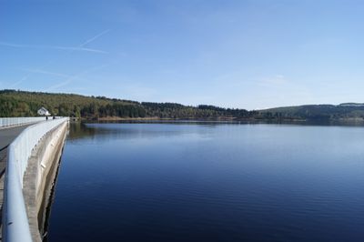
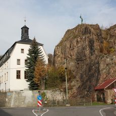
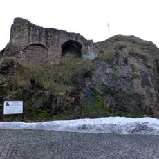
Fláje Reservoir, Water reservoir in Český Jiřetín, Czech Republic

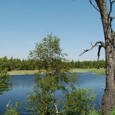
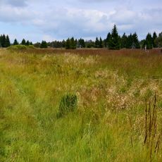
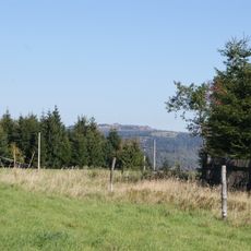
The Fláje Reservoir is a water storage lake in the Krušné Mountains near the Saxon border, situated at approximately 737 meters in elevation and holding a large body of water. The structure features a distinctive dam design with observation areas where visitors can view both the water and surrounding mountain landscape.

Construction of the Fláje Reservoir began in 1951 to manage water flow and protect the surrounding mountain region from flooding. The project represented a major infrastructure effort in the post-World War II development of Czechoslovakia.

The reservoir holds the status of a national cultural monument, showing how communities adapted the landscape to meet their water needs. The dam itself has become a landmark that draws both locals and visitors to the area.

The reservoir is accessible by bus from Litvínov to the Český Jiřetín stop, with walking trails leading to several viewpoints around the water. Spring through fall offers the most comfortable visiting conditions, as paths are clear and weather allows for longer outdoor time.

The dam is the only concrete pillar hollow structure of its kind in the Czech Republic, making it a technical rarity in the country's water infrastructure. This unusual construction method holds particular interest for those curious about engineering solutions.

The community of curious travelers

AroundUs brings together thousands of curated places, local tips, and hidden gems, enriched daily by 60,000 contributors worldwide.

Start exploring
Inception
1951
Elevation above the sea
737.31 m
GPS coordinates
50.68667,13.58222
Latest update
December 7, 2025 20:49
Around this place
Obora Fláje
Czech Republic

Obora Fláje

4.3 km
Lichtenwald
Czech Republic

Lichtenwald

1.6 km
Wieselstein
Czech Republic

Wieselstein

4.7 km
Burgruine Rechenberg
Germany

Burgruine Rechenberg

5.8 km
Grünwaldské vřesoviště
Czech Republic

Grünwaldské vřesoviště

5.5 km
Černý rybník
Czech Republic

Černý rybník

5.3 km
Church of Saint John the Baptist
Czech Republic

Church of Saint John the Baptist

3.5 km
Steinkuppe
Germany

Steinkuppe

3.9 km
Flájská hornatina
Czech Republic

Flájská hornatina

3.7 km
Přírodní park Loučenská hornatina
Czech Republic

Přírodní park Loučenská hornatina

3.8 km
Dům če. 124
Czech Republic

Dům če. 124

3.5 km
Pomník-kříž památce obyvatel zaniklé vsi Fláje
Czech Republic

Pomník-kříž památce obyvatel zaniklé vsi Fláje

2 km
Socha svatého Jana Nepomuckého u Flájské vodní nádrže
Czech Republic

Socha svatého Jana Nepomuckého u Flájské vodní nádrže

2.2 km
Rectory (Český Jiřetín)
Czech Republic

Rectory (Český Jiřetín)

2.7 km
Monument to the fallen in Český Jiřetín
Czech Republic

Monument to the fallen in Český Jiřetín

3.5 km
Muldebrücke in Teichhaus
Germany

Muldebrücke in Teichhaus

5 km
Kříž u kostela v Českém Jiřetíně
Czech Republic

Kříž u kostela v Českém Jiřetíně

3.5 km
Bahnhof Holzhau
Germany

Bahnhof Holzhau

5.3 km
Wohnhaus mit Sonnenuhr und späterem Anbau mit Laden Markt 1
Germany

Wohnhaus mit Sonnenuhr und späterem Anbau mit Laden Markt 1

5.7 km
Podstavec kříže v Českém Jiřetíně u cesty k Horní Vsi
Czech Republic

Podstavec kříže v Českém Jiřetíně u cesty k Horní Vsi

3.1 km
Kříž v ruinách zaniklé vsi Fláje
Czech Republic

Kříž v ruinách zaniklé vsi Fláje

2.1 km
Kříž u silnice z Dlouhé Louky na Moldavu
Czech Republic

Kříž u silnice z Dlouhé Louky na Moldavu

4.1 km
Kgl.-sächs. Postmeilenstein Holzhau
Germany

Kgl.-sächs. Postmeilenstein Holzhau

5.4 km
Podstavec ulomeného kříže v údolí Oldřišského potoka
Czech Republic

Podstavec ulomeného kříže v údolí Oldřišského potoka

5.8 km
Smírčí kříž u zámečku Lichtenwald na vrchu Bradáčov
Czech Republic

Smírčí kříž u zámečku Lichtenwald na vrchu Bradáčov

1.6 km
Kříž na rozcestí pod kostelem v Českém Jiřetíně
Czech Republic

Kříž na rozcestí pod kostelem v Českém Jiřetíně

3.6 km
Burgruine An der Schanze -
Germany

Burgruine An der Schanze -

5.8 km
Kříž v základech zaniklého kostela ve Flájích
Czech Republic

Kříž v základech zaniklého kostela ve Flájích

2.1 km
Show the full map
« Fláje Reservoir - Water reservoir in Český Jiřetín, Czech Republic » is provided by Around Us (aroundus.com). Images and texts are derived from Wikimedia project under a Creative Commons license. You are allowed to copy, distribute, and modify copies of this page, under the conditions set by the license, as long as this note is clearly visible.

Discover hidden gems everywhere you go!

From secret cafés to breathtaking viewpoints, skip the crowded tourist spots and find places that match your style. Our app makes it easy with voice search, smart filtering, route optimization, and insider tips from travelers worldwide. Download now for the complete mobile experience.

Around Us App Screenshot

A unique approach to discovering new places

Le Figaro

All the places worth exploring

France Info

A tailor-made excursion in just a few clicks

20 Minutes

Around Us
Travel Guide & Maps
Download

Send to your phone

QR Code
1

Open the camera app on your mobile.

2

Point at the QR code with your camera. A notification will appear.

3

Tap the notification to open the link.